Area Overview for Newnham
Photos of Newnham


Area Information
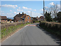
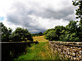
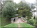
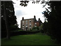
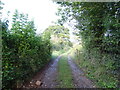
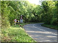
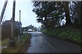
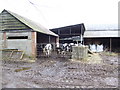
Living in Newnham offers a quiet existence within a small village setting. This civil parish sits in the Forest of Dean district of Gloucestershire, covering an area of approximately 8.5 square kilometres. You will find Newnham on the west bank of the River Severn, a location defined by its geographical position at 51.7988°N, 2.4645°W. The area operates under the Newnham on Severn Parish Council, which manages local community affairs. The landscape is rural rather than urban, suggesting a pace of life that prioritises stillness and connection to nature over city convenience. Daily life here revolves around the immediate surroundings of the parish, with residents relying on local services for their immediate needs. The distinct identity of Newnham as a village rather than a larger town shapes every aspect of the neighbourhood, from street life to local governance. Prospective homeowners should understand they are moving into a historic parish with deep roots in the South West England region. The environment is stable, offering a consistent residential experience without the rapid changes common in developing towns.
- Area Type
- District Borough Unitary Ward
- Area Size
- 8.5 km²
- Population
- Not available
- Population Density
- Not available
Demographics
The community profile of Newnham reveals a very mature population structure. The median age for residents reaches 70 years, indicating a neighbourhood dominated by older adults. Age analysis shows that the total population leans heavily toward this older demographic, which influences local amenities and social activities. Home ownership stands at a high level of 75 per cent, meaning three out of four households own their property outright or with a mortgage. This statistic suggests a community that has settled permanently rather than seeking short-term rentals. The data relies on total household composition figures to paint this picture, without breaking down specific family or single-person metrics. Accommodation type records present as a total category, implying diverse housing solutions exist within the village limits. While specific details on ethnic diversity and religious affiliation are recorded as total figures, the population data confirms an older, property-owning demographic. This profile typically means quieter streets and a slower social rhythm compared to younger, transient areas.
Household Size
Accommodation Type
Tenure
Ethnic Group
Religion
Household Composition
Age
Household Deprivation
NS-SEC
Explore more demographic insights in this area
Go to Demographics tabPlanning
Planning Constraints
- Flood RiskPremium
- Ramsar Wetland SitesPremium
- Area of Outstanding Natural BeautyPremium
- Protected Nature ReservePremium
- Protected WoodlandPremium
- Crime RiskPremium