Area Overview for Newent & Taynton Ward
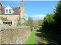
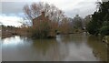
Photos of Newent & Taynton Ward


Area Information
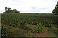
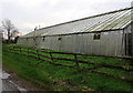
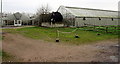
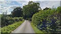
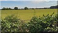
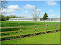
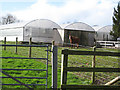
Living in Newent & Taynton Ward offers a quiet rupture from the pace of larger urban centres in Gloucestershire. This electoral ward sits within the Forest of Dean District Council jurisdiction, encompassing the distinct towns of Newent and Taynton. You will find yourself positioned within the Forest of Dean parliamentary constituency at approximately 51.9146°N, 2.3982°W. The geography is compact yet sufficient for a self-contained community, covering a total land area of 36.8 km². A population of 4,575 residents inhabits this space, resulting in a population density of 124 people per km². These figures indicate a sparse, country-style feel rather than a crowded urban environment. Daily life here revolves around a small footprint where local amenities and neighbours are within easy reach. The ward functions as a cohesive unit where the towns of Newent and Taynton share infrastructure and community ties. You can expect a setting defined by open land and a low density of housing units. The area is large enough to provide scope for gardens and private space, yet small enough to maintain strong local connections. This balance makes it a viable option for those seeking a rural postcode without the isolation of the deep countryside.
- Area Type
- District Borough Unitary Ward
- Area Size
- 36.8 km²
- Population
- 4575
- Population Density
- 124 people/km²
Demographics
The community profile for Newent & Taynton Ward distinguishes itself by a very mature population. The median age of residents is 70 years old, which signals a notably older demographic than the national average. Age is a central factor in who lives here, with the total age range reflecting a lifetime settlement in the area. Home ownership stands at a robust 70% of households, suggesting that the majority of residents have purchased their properties over the long term. This high rate of tenure points to families and individuals who have stayed put rather than renters who move frequently. The household composition data indicates a total picture of the area that aligns with an older population seeking stability. Accommodation types are not broken down in the current data, so you must rely on the general speculation of the housing stock based on ownership rates. The predominant ethnic group and religious breakdown are not specified in the available details, meaning the most common identity markers remain unknown. Despite the lack of specific data on diversity or religion, the high home ownership rate and median age create a clear portrait of a settled, older community. There is no indication of wealth deprivation or general poverty metrics in the provided dataset, so you cannot make claims about financial hardship levels. The focus remains on the stability achieved through high property ownership.
Household Size
Accommodation Type
Tenure
Ethnic Group
Religion
Household Composition
Age
Household Deprivation
NS-SEC
Explore more demographic insights in this area
Go to Demographics tabPlanning
Planning Constraints
- Flood RiskPremium
- Ramsar Wetland SitesPremium
- Area of Outstanding Natural BeautyPremium
- Protected Nature ReservePremium
- Protected WoodlandPremium
- Crime RiskPremium