Area Overview for Netheravon
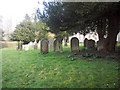
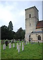
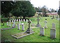
Photos of Netheravon
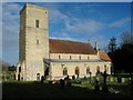
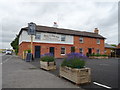
![Netheravon House [1] in Netheravon](https://images.propbar.co.uk/images/geograph/63/90/6390177_120.jpg)
![Netheravon House [2] in Netheravon](https://images.propbar.co.uk/images/geograph/63/90/6390179_120.jpg)
Area Information
Living in Netheravon means residing within a compact built-up area covering just 26.1 hectares in England. This small footprint creates a concentrated community where residents navigate a tight-knit environment rather than sprawling suburbs. The area functions as a distinct town centre surrounded by these physical boundaries, offering a specific scale of living that differs from larger surrounding settlements. You will find that daily life revolves around this central hub, which is large enough to host amenities but small enough to maintain a contained feel. The lack of expansive geographical depth means local services are naturally close to your doorstep, reducing the need for long commutes to reach basic necessities. This concentration defines the character of the neighbourhood, where the built environment is the primary focus. Prospective buyers should understand that they are entering a space defined by its density rather than wide-open spaces or varied topography. The area stands as a defined locality within the wider region, offering a specific type of residential experience suited to those who prefer a settled, close-krit existence. When considering homes in Netheravon, you are looking at a singular, well-bounded community rather than a sprawling district. This clarity allows for a straightforward understanding of what life entails in this particular pocket of England.
- Area Type
- Built Up Area 250
- Area Size
- 26.1 hectares
- Population
- Not available
- Population Density
- Not available
Residents of Netheravon have access to a small but practical selection of retail outlets within easy reach of their homes. Five notable shopping venues operate within the practical daily radius of the community, providing everyday essentials without the need to travel far. You can find a Morrisons Daily, a Sainsburys in Durrington, and a Budgens in Larkhill among the local options. These supermarkets form the backbone of local shopping, covering most grocery and household requirements for the average household. While the data does not list specific independent high-street retailers, cafés, or parks, the concentration of these major chains indicates that daily needs are covered locally. This convenience reduces the frequency with which you must leave the area for basic shopping trips. The presence of stores from different supermarket groups also offers variety in pricing and range for your weekly shop. When considering lifestyle in Netheravon, note that the retail provision is functional rather than extensive. You will have your groceries and essentials sorted quickly, though you may need to travel further for non-food retail, leisure, or specialised services. This setup provides a convenient backdrop to daily life for those who value getting essentials done quickly.
Amenities
Schools
Families researching schools near Netheravon have two primary local options to consider. Both choices are voluntary controlled Church of England primary institutions catering to early education needs. Netheravon All Saints CofE Primary School holds an Ofsted rating of good, a specific designation that confirms its standard of provision aligns with government expectations. The second option is All Saints VA CofE Primary School, which shares similar denominational and educational type characteristics with its neighbour. The presence of two primary schools within the vicinity indicates that this is an established educational route for the local catchment. However, the lack of secondary school names in the provided data means that family planning must look beyond immediate proximity for older children. You will find that the immediate area supports early years and primary education rather than a full secondary cycle. This configuration means families with young children benefit from local alternatives, while those with teenagers must travel further for comprehensive or secondary education. When evaluating schools near Netheravon, note that the local provision is strictly primary and faith-based.
| Rank | School | Type | Entry gender | Ages |
|---|
Explore more schools in this area
Go to Schools tabDemographics
The community in Netheravon reflects a mature population with a median age of 70 years. This age profile suggests a neighbourhood where long-term residents remain and families are less common than older households. You will encounter a demographic where tenure is stable, with 67% of homes in the area owned outright or through a mortgage. Only a minority of residents rent, indicating a zone where property investment and permanence are the norm. The data does not specify the breakdown of age ranges beyond the total median, yet the figure clearly points to a retirement-focused or elderly settlement. This demographic reality shapes the local energy and available services, as the primary residents are likely in retirement or retirement age rather than raising young children. You should expect a quiet atmosphere where community life centres around the needs and activities of older adults. The high ownership rate reinforces this stability, showing that most people in Netheravon have root tenure rather than transient living arrangements. When evaluating homes in Netheravon, consider that the local culture is deeply embedded in the habits of this older population. This is an area defined by longevity and settled living rather than new arrivals or young professionals.
Household Size
Accommodation Type
Tenure
Ethnic Group
Religion
Household Composition
Age
Household Deprivation
NS-SEC
Explore more demographic insights in this area
Go to Demographics tabPlanning
Planning Constraints
- Crime RiskPremium