Area Overview for Mitcheldean, Ruardean & Drybrook Ward
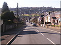
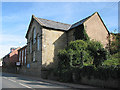
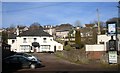
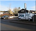
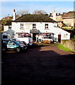
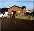
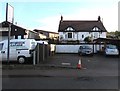
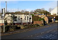
Photos of Mitcheldean, Ruardean & Drybrook Ward
Area Information
Mitcheldean, Ruardean & Drybrook Ward spans 24.3 km² in west Gloucestershire, forming a distinctive district ward within the Forest of Dean. This area encompasses three villages situated within or bordering the Royal Forest, creating a community defined by its historical administrative boundaries and legal regimes. Drybrook sits on the north-west edge of the Forest, roughly three miles from Cinderford and two miles from Mitcheldean. Ruardean and Mitcheldean act as additional forest villages central to the ward. The landscape carries significant medieval weight, characterised by the ruins of St. Briavel's Castle and a history of industrial iron production. In the 12th century, the region supported numerous iron forges and charcoal manufacture, sustaining an economy driven by iron mining and forge production for centuries. Today, the villages maintain their character within this designated royal forest. You are walking into an area where medieval ecclesiastical infrastructure still stands, including the Holy Trinity Church in Drybrook, built in 1817 on Harrow Hill. The setting offers a strong sense of place rooted in centuries of distinct history and industrial heritage. Living here means engaging with a neighbourhood that balances rural tranquility with structured historical significance. The villages function as a cohesive unit under a single ward structure, yet each retains its individual identity within the broader Royal Forest. This unique geographical and historical context shapes daily life for everyone residing in Mitcheldean, Ruardean & Drybrook Ward.
- Area Type
- District Borough Unitary Ward
- Area Size
- 24.3 km²
- Population
- Not available
- Population Density
- Not available
Demographics
The community profile of Mitcheldean, Ruardean && Drybrook Ward reveals an area defined by an older demographic profile. The median age for residents in this ward is 70 years, indicating a significant population of retirees and older adults. While specific data on household composition categories or predominant ethnic groups is not listed in the provided overview, the age statistics paint a clear picture of the typical resident. You are joining a community where life expectancy and senior living are central themes. Homeownership levels are exceptionally high within this ward, with 77% of homes owned outright by their occupants. This figure stands in direct contrast to rental-dominated areas, suggesting a settlement where long-term residents have established deep roots over time. The high rate of ownership correlates with the static nature of the local population and the historical development of the villages. Accommodation types follow this ownership pattern, reinforcing the idea that most households consist of families or individuals who have remained in the area for generations. There is no evidence of recent large-scale inward migration or transient housing markets. The demographic data confirms a stable, settled environment where local institutions and social networks have remained relatively consistent for decades. Residents of Mitcheldean, Ruardean & Drybrook Ward experience daily life in a neighbourhood where the majority have been homeowners for extended periods.
Household Size
Accommodation Type
Tenure
Ethnic Group
Religion
Household Composition
Age
Household Deprivation
NS-SEC
Explore more demographic insights in this area
Go to Demographics tabPlanning
Planning Constraints
- Flood RiskLocked
- Ramsar Wetland SitesLocked
- Area of Outstanding Natural BeautyLocked
- Protected Nature ReserveLocked
- Protected WoodlandLocked
- Crime RiskLocked