Area Overview for Marazion
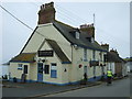
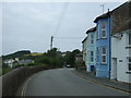
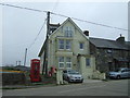
Photos of Marazion


Area Information
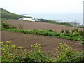
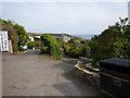
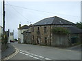
Marazion occupies a footprint of 64.5 hectares within the built-up area classification for this Cornish town. This relatively compact size defines a neighbourhood where residents navigate the community with ease, avoiding the sprawling distances often associated with larger urban centres. Living in Marazion means existing within a defined town boundary that balances coastal proximity with practical access to mainland facilities. The area's character is shaped by its status as a standalone settlement distinct from nearby Penzance, yet connected by regular transport links. You will find a residential environment that prioritises proximity to local services over expansive suburbs. Daily life revolves around the immediate neighbourhood, with the majority of essential requirements located within a short walk or drive. The town functions as a self-contained unit where the rhythm of life is dictated by local tides and seasonal tourism rather than the sporadic employment peaks or valleys of a corporate city centre. This geographical reality creates a distinct pace for living, protecting residents from commuter gridlock while ensuring they remain connected to the broader West Penwith region.
- Area Type
- Built Up Area 250
- Area Size
- 64.5 hectares
- Population
- Not available
- Population Density
- Not available
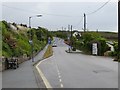
Your access to daily amenities in Marazion is defined by a network of convenient services within practical reach. Retail needs are met by five identifiable locations, including Spar, Morrisons Long, and Sainsburys Penzance. These supermarkets provide you with the weekly groceries and household essentials without the need to travel long distances into urban centres. For your commuting or travel needs, the area benefits from excellent rail connectivity with five identified stations nearby: Penzance Railway Station, St Erth Railway Station, and Lelant Saltings Railway Station. While Marazion itself hosts the core retail outlets, the proximity to Penzance ensures that broader shopping options or specialist services are easily accessible by train or car. This convenience anchors your lifestyle, ensuring that buying a house here does not mean compromising on the essential services you require. The combination of local grocers and major railway hubs creates a practical environment where you can manage your home life and your travel plans with equal ease.
Amenities
Schools
Education provision for young families in Marazion is centred primarily around Marazion School. This institution operates as a primary school and holds an Ofsted rating of good. The presence of a single named primary school within the immediate catchment indicates that younger children have a clear, local educational destination. This school rating provides assurance on the quality of education available, though the absence of listed secondary schools in the data implies that older students may require transport to facilities in Penzance or further afield. For residents of Marazion, your nearest educational option remains this primary institution. The limited school data suggests that the town serves the educational needs of younger children, while families with teenagers might look beyond the borough boundaries for their children's secondary education. When evaluating Marazion for young children, the good rating of Marazion School is the key educational metric available for your review.
| Rank | School | Type | Entry gender | Ages |
|---|
Explore more schools in this area
Go to Schools tabDemographics
The community within Marazion presents a clear demographic profile, with a median age standing at 70 years. This statistic indicates that the population is significantly skewed towards older residents, shaping the social fabric of the town. A home ownership rate of 67% reveals that most households in Marazion own their property outright or with a mortgage, accompanied by a substantial legacy of resident tenure. This high level of occupancy suggests a stable community where long-term settlement is the norm rather than transient living arrangements. The data does not specify the predominant ethnic group or religious breakdown, but the age and ownership figures alone illustrate a settled, mature population. Residents are more likely to be those seeking a quiet retirement or a permanent base near the coast rather than young professionals or families in the traditional commuter sense. This demographic reality means the local shops and community groups cater predominantly to the needs, interests, and schedules of an older generation. The town exists as a neighbourhood for those who have put down roots and intend to remain there for the long term.
Household Size
Accommodation Type
Tenure
Ethnic Group
Religion
Household Composition
Age
Household Deprivation
NS-SEC
Explore more demographic insights in this area
Go to Demographics tabPlanning
Planning Constraints
- Crime RiskPremium