Area Overview for Mamhead
Photos of Mamhead


Area Information
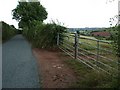
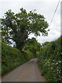
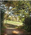
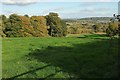
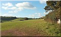
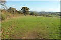
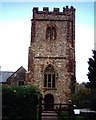
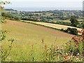
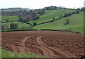
Living in Mamhead offers a distinctly rural experience within the civil parish of southern Devon. You will find this area is compact and defined by its terrain rather than a large village centre. The parish covers just 4.8 km², which creates a closely knit environment without the density of urban infrastructure. Daily life here is likely quiet and paced at a slower rhythm than in bigger towns. There are no industrial estates or heavy traffic corridors to disrupt your routine. Instead, the landscape remains the primary feature of your surroundings. The population statistics reveal this is a place favoured by those seeking stability rather than urban dynamism. The demographic profile suggests a settlement that has evolved organically over decades, with housing built primarily for long-term residence. You are moving into an established community where the daily activities of your neighbours centre on local transport links and natural amenities. The size of the parish dictates that services are a short drive away rather than within walking distance. This layout provides security and privacy while maintaining access to regional facilities. When considering homes in Mamhead, you are entering a market characterised by ownership and permanence. The built environment reflects a preference for detached or semi-detached family homes over high-density apartments. The lack of significant planning constraints means the physical character of the parish is well-preserved. Your focus will be on finding a property that suits your specific needs within this limited geographical footprint. The area stands apart from commercial hubs, offering a retreat from the busy roads of the M5 motorway network. You gain a home in a setting where the priority is residential peace.
- Area Type
- Parish
- Area Size
- 4.8 km²
- Population
- Not available
- Population Density
- Not available
Demographics
The community in Mamhead is defined by a clear age demographic, with a median age of 70. This figure indicates that the majority of residents are retirees, which shapes the social atmosphere of the parish. You will likely encounter fewer young families moving in compared to areas near university towns or employment hubs. The older population pushes the median age upward significantly, creating a demographic profile typical of many Exmoor fringe settlements. Home ownership stands at a very high level, with 77% of residents owning their homes free or with a mortgage. This statistic confirms that the area is built on a foundation of stability rather than transient renting. The remaining 23% of the population are tenants, which ensures a small rental market does exist for those who cannot afford local purchasing prices. The household composition reflects this ownership structure, with fewer shared-households found in this age group compared to younger populations. You should expect a predominantly white population, as this is the standard ethnic group for the United Kingdom and specifically for rural Devon parishes. Religion data, while not specified in the raw figures, aligns with the general decline in church attendance seen across rural England. The area does not have the diverse ethnic mix found in coastal holiday towns or industrial cities. Instead, the community remains homogenous in both age and background. For a potential resident, this translates to a neighbourhood where social interactions are frequent due to similar life stages and economic backgrounds. The population data paints a clear picture of a quiet, stable community focused on the later stages of adulthood.
Household Size
Accommodation Type
Tenure
Ethnic Group
Religion
Household Composition
Age
Household Deprivation
NS-SEC
Explore more demographic insights in this area
Go to Demographics tabPlanning
Planning Constraints
- Flood RiskPremium
- Ramsar Wetland SitesPremium
- Area of Outstanding Natural BeautyPremium
- Protected Nature ReservePremium
- Protected WoodlandPremium
- Crime RiskPremium