Area Overview for Latton
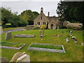
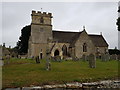
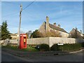
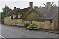
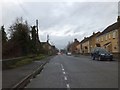
Photos of Latton
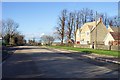

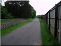
![A circular walk around Cricklade [41] in Latton](https://images.propbar.co.uk/images/geograph/63/39/6339049_120.jpg)

Area Information
Latton is a built-up area covering 23.6 hectares, situated within the wider context of Cricklade. Living in Latton means residing in a compact neighbourhood where the community feels close-knit due to the limited physical footprint. The area is entirely within the built-up classification, distinguishing it from the surrounding countryside while maintaining a residential character. You will find the core of the locality concentrated here, offering a sense of place that is distinct from the larger towns nearby. This setting provides a quiet environment suitable for those who value space without the isolation of rural hamlets. The area serves as a residential pocket, integral to the local housing market and community structure of the region. For homebuyers, Latton represents a specific choice within the Cricklade postal district, offering a manageable size for local services and social interaction. The 23.6-square-hectare extent ensures that amenities and neighbours are within easy reach by foot or short car journey. This definition of the area helps you understand the scale of daily life, which revolves around a tight-krit community rather than urban sprawl. You are choosing an established location where the geographical boundaries are clear, providing a defined sense of home. The area's classification as a built-up zone confirms its integration into the local infrastructure, ensuring residents have access to the essential networks required for modern living.
- Area Type
- Built Up Area 250
- Area Size
- 23.6 hectares
- Population
- Not available
- Population Density
- Not available
Amenities
Schools
| Rank | A + A* % | School | Type | Entry gender | Ages |
|---|
Explore more schools in this area
Go to Schools tabDemographics
The community in Latton has a distinct demographic profile, characterised by a median age of 70 years. This figure indicates a population skewed significantly towards older residents, suggesting the area appeals to retirees or those seeking a quiet lifestyle away from younger crowds. You are entering a neighbourhood where the daily rhythm is likely slower, reflecting the needs and preferences of an aging population. The most common age range data categorises the total demographic, reinforcing that the vast majority of inhabitants fall into this older bracket. This age structure shapes the local demand for services and social activities. Home ownership stands at 82% within Latton, placing ownership rates well above the national average. This high level of tenure suggests that the majority of residents have secured equity in their homes and are likely motivated homeowners rather than tenants. When considering homes in Latton, you will predominantly find properties occupied by those who stay put, leading to a stable neighbourhood with long-term residents. The accommodation type data reflects this total picture, showing that the housing stock is dominated by owner-occupied dwellings. This stability contributes to the area's character, where families or couples often live for decades, creating deep-rooted local connections. The diversity and religion data cover the total population, indicating a community that has settled over many years.
Household Size
Accommodation Type
Tenure
Ethnic Group
Religion
Household Composition
Age
Household Deprivation
NS-SEC
Explore more demographic insights in this area
Go to Demographics tabPlanning
Planning Constraints
- Crime RiskLocked