Area Overview for HR9 7SP
Photos of HR9 7SP
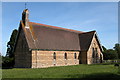
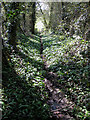
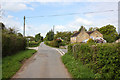
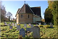
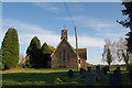
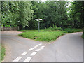
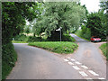
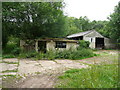
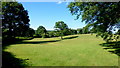
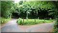
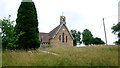
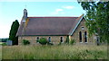
78 photos from this area
Area Information
Key information about the HR9 7SP including its size, population, and administrative classification.
- Area Type
- Postcode
- Area Size
- 45.4 hectares
- Population
- 1798
- Population Density
- 69 people/km²
House Prices in HR9 7SP
18
Properties
£484,688
Average Sold Price
£270,000
Lowest Price
£860,000
Highest Price
Showing 18 properties
| Address | Type | Beds | Baths | Last Sale Price | Last Sale Date | |
|---|---|---|---|---|---|---|
| The Lodge, Ross Road, Gorsley, HR9 7SP | Cottage | 2 | 1 | £440,000 | Dec 2023 | |
| Old School House, Ross Road, Gorsley, HR9 7SP | house | 5 | 5 | £860,000 | Sep 2023 | |
| Ryelands, Ross Road, Gorsley, HR9 7SP | hospital_care_home | - | - | £620,000 | Mar 2022 | |
| The Poplars, Ross Road, Gorsley, HR9 7SP | Detached | 4 | 1 | £440,000 | Oct 2020 | |
| Hartleys Barn, Ross Road, Gorsley, HR9 7SP | Detached | 4 | 3 | £367,500 | Feb 2019 | |
| Hillside Cottage, Ross Road, Gorsley, HR9 7SP | Detached | 4 | 2 | £520,000 | Sep 2016 | |
| Haymoor, Ross Road, Gorsley, HR9 7SP | Land | - | - | £270,000 | Feb 2015 | |
| The Old Vicarage, Ross Road, Gorsley, HR9 7SP | Detached | 4 | 2 | £360,000 | Dec 2001 | |
| Former Mobile Home, Poplars Farm, Ross Road, Gorsley, HR9 7SP | Mobile Home | - | - | - | - | |
| Plot 1 Linton Hall Demolitiion Of Cottage And Erection Of Replacement Cottage, B 4221 Gorsley To Gloucestershire Boundary East Of Gorsley Road, Gorsley, HR9 7SP | Detached | - | - | - | - |
Page 1 of 2
Energy Efficiency in HR9 7SP
Amenities
Schools
| Rank | School | Type | Entry gender | Ages |
|---|
Explore more schools in this area
Go to Schools tabDemographics
Household Size
Two person
most common
Accommodation Type
Houses
most common
Tenure
80
majority
Ethnic Group
White
most common
Religion
N/A
most common
Household Composition
N/A
most common
Age
47
median
Adults (30-64 years)
most common
Household Deprivation
N/A
with no deprivation
NS-SEC
35
in Lower managerial occupations
Explore more demographic insights in this area
Go to Demographics tabPlanning
Planning Constraints
- Flood RiskPremium
- Ramsar Wetland SitesPremium
- Area of Outstanding Natural BeautyPremium
- Protected Nature ReservePremium
- Protected WoodlandPremium