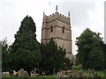
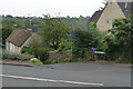
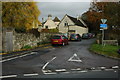
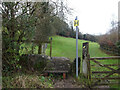
Area Overview for Horsley (Stroud)
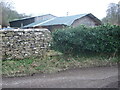
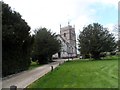
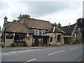
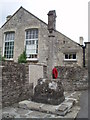
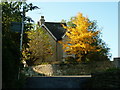
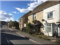
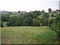
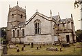
Photos of Horsley (Stroud)
Area Information
Living in Horsley (Stroud) offers a distinct blend of quietude and practicality. Situated in England, this built-up area covers 34 hectares, providing a compact yet functional space for residents. The community here is predominantly older, with a median age of 70, reflecting a settled population. Home ownership is high, at 80%, suggesting a stable, long-term presence of residents. Daily life in Horsley (Stroud) is shaped by its proximity to essential services and transport links. The area’s safety is a notable feature, with a crime risk score of 82, indicating below-average crime rates and a secure environment. Nearby, Horsley Church of England Primary School offers a good Ofsted-rated education for younger families, while retail hubs like Co-op Nailsworth and Tesco Nailsworth ensure convenience. For commuters, three railway stations—Stroud, Stonehouse, and Cam & Dursley—provide easy access to surrounding areas. Horsley (Stroud) is ideal for those seeking a low-maintenance, safe neighbourhood with practical amenities within reach.
- Area Type
- Built Up Area 250
- Area Size
- 34.0 hectares
- Population
- Not available
- Population Density
- Not available
The lifestyle in Horsley (Stroud) is shaped by its proximity to essential amenities. Within walking or short driving distance, residents have access to five retail outlets, including Co-op Nailsworth, Tesco Nailsworth, and Morrisons Nailsworth. These stores provide a range of goods, from groceries to household items, reducing the need for long trips. The three nearby railway stations—Stroud, Stonehouse, and Cam & Dursley—offer easy access to broader regional networks, facilitating commuting or leisure travel. While the data does not mention parks or recreational facilities, the presence of retail and transport hubs suggests a practical, convenience-focused lifestyle. For those valuing ease of access to shopping and transport, Horsley (Stroud) delivers a straightforward, functional daily experience.
Amenities
Schools
Horsley (Stroud) is served by Horsley Church of England Primary School, a primary school with a good Ofsted rating. This institution provides a solid foundation for young learners, ensuring families have access to quality early education. The absence of secondary schools in the data means residents may need to travel to nearby towns for further education. For primary school-aged children, the local school offers a reliable option, reducing the need for long commutes. The good rating indicates effective teaching and facilities, which is crucial for parents prioritising educational standards. While the data does not mention other schools, the presence of one well-rated primary school is a positive factor for families.
| Rank | School | Type | Entry gender | Ages |
|---|
Explore more schools in this area
Go to Schools tabDemographics
Horsley (Stroud) has a median age of 70, the highest demographic bracket in the data, suggesting a community dominated by older adults. The home ownership rate is 80%, a strong indicator of long-term residency and financial stability. The household composition and accommodation types are not specified, but the high home ownership percentage implies a predominantly owner-occupied area with fewer rental properties. The data does not provide details on ethnic diversity or religious composition, but the overall population appears to be relatively homogeneous. The absence of specific deprivation metrics means the area’s quality of life cannot be assessed in terms of economic hardship, though the safety and amenities suggest a comfortable standard of living. For residents, the demographic profile aligns with a mature, settled population prioritising stability over dynamic growth.
Household Size
Accommodation Type
Tenure
Ethnic Group
Religion
Household Composition
Age
Household Deprivation
NS-SEC
Explore more demographic insights in this area
Go to Demographics tabPlanning
Planning Constraints
- Crime RiskPremium