Area Overview for GL9 1HF
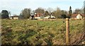
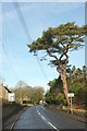
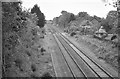
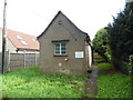
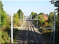
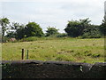
Photos of GL9 1HF
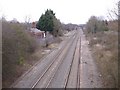
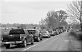
![Acton Turville houses [14] in GL9 1HF](https://images.propbar.co.uk/images/geograph/58/99/5899460_120.jpg)
![Acton Turville houses [16] in GL9 1HF](https://images.propbar.co.uk/images/geograph/58/99/5899462_120.jpg)
![Acton Turville houses [17] in GL9 1HF](https://images.propbar.co.uk/images/geograph/58/99/5899465_120.jpg)
![Acton Turville houses [18] in GL9 1HF](https://images.propbar.co.uk/images/geograph/58/99/5899469_120.jpg)
53 photos from this area
Area Information
Key information about the GL9 1HF including its size, population, and administrative classification.
- Area Type
- Postcode
- Area Size
- 2.0 hectares
- Population
- 1690
- Population Density
- 35 people/km²
House Prices in GL9 1HF
5
Properties
£529,875
Average Sold Price
£179,750
Lowest Price
£880,000
Highest Price
Showing 5 properties
| Address | Type | Beds | Baths | Last Sale Price | Last Sale Date | |
|---|---|---|---|---|---|---|
| Park Cottages, Badminton Road, Acton Turville, GL9 1HF | Bungalow | 4 | - | £880,000 | Feb 2019 | |
| Limes Farmhouse, Badminton Road, Acton Turville, GL9 1HF | Detached | - | - | £179,750 | Aug 1995 | |
| The Spinney, Limes Farm, Luckington Road, Acton Turville, GL9 1HF | Detached | - | - | - | - | |
| 1, Park Cottages, Badminton Road, Acton Turville, GL9 1HF | Semi-detached | - | - | - | - | |
| 1-2, Park Cottages, Badminton Road, Acton Turville, GL9 1HF | Detached | - | - | - | - |
Energy Efficiency in GL9 1HF
Amenities
Schools
| Rank | School | Type | Entry gender | Ages |
|---|
Explore more schools in this area
Go to Schools tabDemographics
Household Size
Two person
most common
Accommodation Type
Houses
most common
Tenure
64
majority
Ethnic Group
White
most common
Religion
N/A
most common
Household Composition
N/A
most common
Age
47
median
Adults (30-64 years)
most common
Household Deprivation
N/A
with no deprivation
NS-SEC
40
in Lower managerial occupations
Explore more demographic insights in this area
Go to Demographics tabPlanning
Planning Constraints
- Flood RiskPremium
- Ramsar Wetland SitesPremium
- Area of Outstanding Natural BeautyPremium
- Protected Nature ReservePremium
- Protected WoodlandPremium