Area Overview for GL7 6NZ
Photos of GL7 6NZ


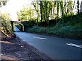
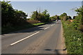
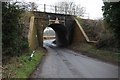
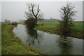
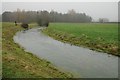
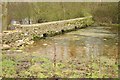
99 photos from this area
Area Information
Key information about the GL7 6NZ including its size, population, and administrative classification.
- Area Type
- Postcode
- Area Size
- 1.6 km²
- Population
- 2091
- Population Density
- 51 people/km²
House Prices in GL7 6NZ
13
Properties
£672,683
Average Sold Price
£570,000
Lowest Price
£773,050
Highest Price
Showing 13 properties
| Address | Type | Beds | Baths | Last Sale Price | Last Sale Date | |
|---|---|---|---|---|---|---|
| 77 Tetbury Road, Cirencester, GL7 6NZ | Semi-detached | 4 | 2 | £675,000 | Sep 2021 | |
| Trewsbury Lodge, Tetbury Road, Cirencester, GL7 6NZ | house | 4 | - | £570,000 | Nov 2015 | |
| Thames Head House, Tetbury Road, Cirencester, GL7 6NZ | Detached | - | - | £773,050 | Dec 2003 | |
| Thames Head Wharf Cottage, Tetbury Road, Cirencester, GL7 6NZ | Detached | 4 | 3 | - | - | |
| Trewsbury Farm, Tetbury Road, Cirencester, GL7 6NZ | Detached | - | - | - | - | |
| Flat 2, Trewsbury Farm, Tetbury Road, Cirencester, GL7 6NZ | Flat | - | - | - | - | |
| Flat 1, Trewsbury Farm, Tetbury Road, Cirencester, GL7 6NZ | Flat | - | - | - | - | |
| Coxs Cottage, Tetbury Road, Cirencester, GL7 6NZ | Detached | - | - | - | - | |
| Tennis 77M From Trewsbury Farm, Tetbury Road 35M From Unnamed Road, Coates Footpath 14, Coates, GL7 6NZ | Leisure | - | - | - | - | |
| Thames Head Barn, Tetbury Road, Cirencester, GL7 6NZ | house | - | - | - | - |
Page 1 of 2
Energy Efficiency in GL7 6NZ
Amenities
Schools
| Rank | School | Type | Entry gender | Ages |
|---|
Explore more schools in this area
Go to Schools tabDemographics
Household Size
Two person
most common
Accommodation Type
Houses
most common
Tenure
67
majority
Ethnic Group
White
most common
Religion
N/A
most common
Household Composition
N/A
most common
Age
47
median
Adults (30-64 years)
most common
Household Deprivation
N/A
with no deprivation
NS-SEC
47
in Lower managerial occupations
Explore more demographic insights in this area
Go to Demographics tabPlanning
Planning Constraints
- Flood RiskPremium
- Ramsar Wetland SitesPremium
- Area of Outstanding Natural BeautyPremium
- Protected Nature ReservePremium
- Protected WoodlandPremium