Area Overview for GL7 3AH
Photos of GL7 3AH
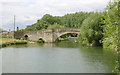
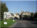
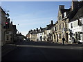
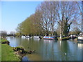
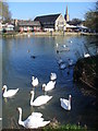
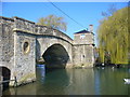
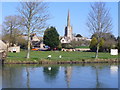

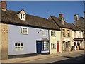
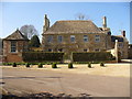
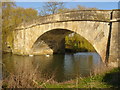

100 photos from this area
Area Information
Key information about the GL7 3AH including its size, population, and administrative classification.
- Area Type
- Postcode
- Area Size
- 1.9 hectares
- Population
- 1490
- Population Density
- 305 people/km²
House Prices in GL7 3AH
32
Properties
£310,768
Average Sold Price
£97,000
Lowest Price
£555,000
Highest Price
Showing 32 properties
| Address | Type | Beds | Baths | Last Sale Price | Last Sale Date | |
|---|---|---|---|---|---|---|
| Plum Tree Cottage, Sherborne Street, Lechlade, GL7 3AH | Semi-detached | 3 | 2 | £317,500 | Jun 2023 | |
| Mollies Cottage, Sherborne Street, Lechlade, GL7 3AH | Cottage | 2 | - | £290,000 | Jun 2021 | |
| Kingscot, Sherborne Street, Lechlade, GL7 3AH | Terraced | 2 | 1 | £258,000 | Sep 2018 | |
| Cliffords Cottage, Sherborne Street, Lechlade, GL7 3AH | Cottage | 3 | 2 | £400,000 | Feb 2016 | |
| Windemere, Sherborne Street, Lechlade, GL7 3AH | house | 3 | 1 | £335,000 | Aug 2013 | |
| Sherborne House Cottage, Sherborne Street, Lechlade, GL7 3AH | Detached | - | - | £315,000 | Aug 2010 | |
| Hunters Moon, Sherborne Street, Lechlade, GL7 3AH | Semi-detached | 5 | 2 | £555,000 | Jul 2007 | |
| Kent House, Sherborne Street, Lechlade, GL7 3AH | Detached | - | - | £375,000 | Nov 2004 | |
| Bury House, Sherborne Street, Lechlade, GL7 3AH | Detached | - | - | £373,750 | May 2004 | |
| Rose Cottage, Sherborne Street, Lechlade, GL7 3AH | Detached | - | - | £202,000 | Jun 2003 |
Page 1 of 4
Energy Efficiency in GL7 3AH
Amenities
Schools
| Rank | School | Type | Entry gender | Ages |
|---|
Explore more schools in this area
Go to Schools tabDemographics
Household Size
Two person
most common
Accommodation Type
Houses
most common
Tenure
63
majority
Ethnic Group
White
most common
Religion
N/A
most common
Household Composition
N/A
most common
Age
47
median
Adults (30-64 years)
most common
Household Deprivation
N/A
with no deprivation
NS-SEC
32
in Lower managerial occupations
Explore more demographic insights in this area
Go to Demographics tabPlanning
Planning Constraints
- Flood RiskPremium
- Ramsar Wetland SitesPremium
- Area of Outstanding Natural BeautyPremium
- Protected Nature ReservePremium
- Protected WoodlandPremium