Area Overview for GL7 2LR
Photos of GL7 2LR
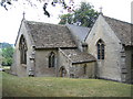
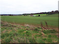
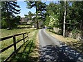
![A walk through Cirencester Park and Stratton [24] in GL7 2LR](https://images.propbar.co.uk/images/geograph/68/44/6844932_120.jpg)
19 photos from this area
Area Information
Key information about the GL7 2LR including its size, population, and administrative classification.
- Area Type
- Postcode
- Area Size
- 28.5 hectares
- Population
- 1845
- Population Density
- 619 people/km²
House Prices in GL7 2LR
8
Properties
£1,900,000
Average Sold Price
£1,900,000
Lowest Price
£1,900,000
Highest Price
Showing 8 properties
| Address | Type | Beds | Baths | Last Sale Price | Last Sale Date | |
|---|---|---|---|---|---|---|
| Stratton Grange, Gloucester Road, Stratton, GL7 2LR | Terraced | - | - | £1,900,000 | Apr 2018 | |
| Threshing Barn, Grange Farm, Gloucester Road, Stratton, GL7 2LR | Detached | 4 | 3 | - | - | |
| The Flat, Stratton Grange, Gloucester Road, Stratton, GL7 2LR | Semi-detached | 2 | 2 | - | - | |
| Stratton Cemetery, Gloucester Road, Stratton, GL7 2LR | commercial | - | - | - | - | |
| Tennis 47M From Mulberry House Grange Farm, Gloucester Road 13M From Unnamed Road, 3/188 Gloucester Road Cirencester To Daglingworth, Daglingworth, GL7 2LR | Leisure | - | - | - | - | |
| Mulberry House, Grange Farm, Gloucester Road, Stratton, GL7 2LR | Bungalow | - | - | - | - | |
| Parkside, Grange Farm, Gloucester Road, Stratton, GL7 2LR | house | - | - | - | - | |
| Stonefield, Grange Farm, Gloucester Road, Stratton, GL7 2LR | Detached | - | - | - | - |
Energy Efficiency in GL7 2LR
Amenities
Schools
| Rank | School | Type | Entry gender | Ages |
|---|
Explore more schools in this area
Go to Schools tabDemographics
Household Size
Two person
most common
Accommodation Type
Houses
most common
Tenure
87
majority
Ethnic Group
White
most common
Religion
N/A
most common
Household Composition
N/A
most common
Age
47
median
Adults (30-64 years)
most common
Household Deprivation
N/A
with no deprivation
NS-SEC
41
in Lower managerial occupations
Explore more demographic insights in this area
Go to Demographics tabPlanning
Planning Constraints
- Flood RiskPremium
- Ramsar Wetland SitesPremium
- Area of Outstanding Natural BeautyPremium
- Protected Nature ReservePremium
- Protected WoodlandPremium