Area Overview for GL7 1LD
Photos of GL7 1LD


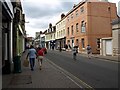
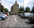
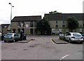
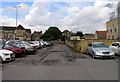
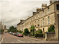
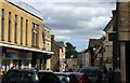

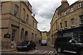
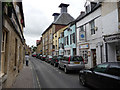
100 photos from this area
Area Information
Key information about the GL7 1LD including its size, population, and administrative classification.
- Area Type
- Postcode
- Area Size
- 1.0 hectares
- Population
- 1616
- Population Density
- 4159 people/km²
House Prices in GL7 1LD
53
Properties
£205,581
Average Sold Price
£47,700
Lowest Price
£500,000
Highest Price
Showing 53 properties
| Address | Type | Beds | Baths | Last Sale Price | Last Sale Date | |
|---|---|---|---|---|---|---|
| 107 Watermoor Road, Cirencester, GL7 1LD | Terraced | 3 | 1 | £190,000 | Jul 2024 | |
| 70 Watermoor Road, Cirencester, GL7 1LD | Terraced | 4 | 2 | £310,000 | Feb 2023 | |
| 115 Watermoor Road, Cirencester, GL7 1LD | Terraced | 3 | 1 | £265,000 | May 2022 | |
| 46 Watermoor Road, Cirencester, GL7 1LD | house | - | - | £500,000 | Dec 2020 | |
| 85 Watermoor Road, Cirencester, GL7 1LD | Terraced | 3 | 1 | £253,000 | Nov 2020 | |
| 56 Watermoor Road, Cirencester, GL7 1LD | Terraced | 3 | 2 | £272,000 | Jun 2020 | |
| 48 Watermoor Road, Cirencester, GL7 1LD | Terraced | 3 | 2 | £319,000 | Dec 2017 | |
| 52 Watermoor Road, Cirencester, GL7 1LD | Terraced | - | - | £317,500 | Jun 2015 | |
| 72 Watermoor Road, Cirencester, GL7 1LD | Terraced | 2 | 1 | £205,000 | Jun 2014 | |
| 87 Watermoor Road, Cirencester, GL7 1LD | Terraced | 3 | 1 | £175,000 | Jan 2014 |
Page 1 of 6
Energy Efficiency in GL7 1LD
Amenities
Schools
| Rank | School | Type | Entry gender | Ages |
|---|
Explore more schools in this area
Go to Schools tabDemographics
Household Size
One person
most common
Accommodation Type
Houses
most common
Tenure
62
majority
Ethnic Group
White
most common
Religion
N/A
most common
Household Composition
N/A
most common
Age
47
median
Adults (30-64 years)
most common
Household Deprivation
N/A
with no deprivation
NS-SEC
43
in Lower managerial occupations
Explore more demographic insights in this area
Go to Demographics tabPlanning
Planning Constraints
- Flood RiskPremium
- Ramsar Wetland SitesPremium
- Area of Outstanding Natural BeautyPremium
- Protected Nature ReservePremium
- Protected WoodlandPremium