Area Overview for GL6 9EW
Photos of GL6 9EW
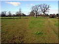
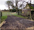

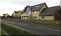
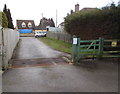

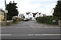
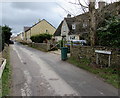
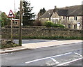
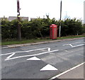
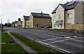
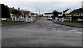
45 photos from this area
Area Information
Key information about the GL6 9EW including its size, population, and administrative classification.
- Area Type
- Postcode
- Area Size
- 2.3 hectares
- Population
- 1499
- Population Density
- 1006 people/km²
House Prices in GL6 9EW
29
Properties
£242,050
Average Sold Price
£47,000
Lowest Price
£500,000
Highest Price
Showing 29 properties
| Address | Type | Beds | Baths | Last Sale Price | Last Sale Date | |
|---|---|---|---|---|---|---|
| 17 The Tynings, Minchinhampton, GL6 9EW | Semi-detached | 4 | 2 | £395,000 | Nov 2023 | |
| 31 The Tynings, Minchinhampton, GL6 9EW | Semi-detached | 3 | 1 | £320,000 | Mar 2021 | |
| Tinkers Yard, The Tynings, Minchinhampton, GL6 9EW | Bungalow | - | - | £500,000 | Dec 2018 | |
| 15 The Tynings, Minchinhampton, GL6 9EW | Detached | 4 | 1 | £355,000 | Nov 2018 | |
| 21 The Tynings, Minchinhampton, GL6 9EW | Semi-detached | - | - | £152,000 | Nov 2010 | |
| 34 The Tynings, Minchinhampton, GL6 9EW | Semi-detached | - | - | £224,750 | Jul 2006 | |
| 26 The Tynings, Minchinhampton, GL6 9EW | Semi-detached | - | - | £115,000 | Apr 2003 | |
| 23 The Tynings, Minchinhampton, GL6 9EW | Semi-detached | - | - | £69,700 | Sep 1999 | |
| 35 The Tynings, Minchinhampton, GL6 9EW | Semi-detached | - | - | £47,000 | Oct 1995 | |
| 39 The Tynings, Minchinhampton, GL6 9EW | Semi-detached | - | - | - | - |
Page 1 of 3
Energy Efficiency in GL6 9EW
Amenities
Schools
| Rank | School | Type | Entry gender | Ages |
|---|
Explore more schools in this area
Go to Schools tabDemographics
Household Size
Two person
most common
Accommodation Type
Houses
most common
Tenure
58
majority
Ethnic Group
White
most common
Religion
N/A
most common
Household Composition
N/A
most common
Age
47
median
Adults (30-64 years)
most common
Household Deprivation
N/A
with no deprivation
NS-SEC
33
in Lower managerial occupations
Explore more demographic insights in this area
Go to Demographics tabPlanning
Planning Constraints
- Flood RiskPremium
- Ramsar Wetland SitesPremium
- Area of Outstanding Natural BeautyPremium
- Protected Nature ReservePremium
- Protected WoodlandPremium