Area Overview for GL6 9EH
Photos of GL6 9EH
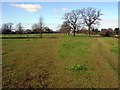
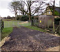

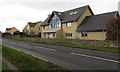
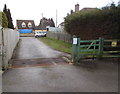

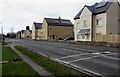
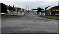
45 photos from this area
Area Information
Key information about the GL6 9EH including its size, population, and administrative classification.
- Area Type
- Postcode
- Area Size
- 7.9 hectares
- Population
- 1499
- Population Density
- 1006 people/km²
House Prices in GL6 9EH
85
Properties
£386,795
Average Sold Price
£11,840
Lowest Price
£675,000
Highest Price
Showing 85 properties
| Address | Type | Beds | Baths | Last Sale Price | Last Sale Date | |
|---|---|---|---|---|---|---|
| The Bellows, Old Common, Minchinhampton, GL6 9EH | Detached | 4 | 2 | £467,500 | Sep 2025 | |
| Pippins, Old Common, Minchinhampton, GL6 9EH | Bungalow | 2 | 1 | £360,000 | Mar 2025 | |
| Ryecroft, Old Common, Minchinhampton, GL6 9EH | Semi-detached | 3 | 1 | £490,000 | Sep 2024 | |
| 6A Old Common, Minchinhampton, GL6 9EH | Retail | 3 | 1 | £425,000 | Oct 2022 | |
| 8A Old Common, Minchinhampton, GL6 9EH | Semi-detached | 2 | 1 | £325,000 | Jul 2022 | |
| Stonecroft, Old Common, Minchinhampton, GL6 9EH | Bungalow | - | - | £675,000 | Jan 2022 | |
| Verona, Old Common, Minchinhampton, GL6 9EH | house | 4 | - | £600,000 | Apr 2020 | |
| Weathertop, Old Common, Minchinhampton, GL6 9EH | Detached | 4 | 2 | £575,000 | Oct 2019 | |
| 13 Old Common, Minchinhampton, GL6 9EH | Detached | 4 | 2 | £420,000 | May 2018 | |
| Sheepstor, Old Common, Minchinhampton, GL6 9EH | Detached | - | - | £599,950 | Sep 2017 |
Page 1 of 9
Energy Efficiency in GL6 9EH
Amenities
Schools
| Rank | School | Type | Entry gender | Ages |
|---|
Explore more schools in this area
Go to Schools tabDemographics
Household Size
Two person
most common
Accommodation Type
Houses
most common
Tenure
58
majority
Ethnic Group
White
most common
Religion
N/A
most common
Household Composition
N/A
most common
Age
47
median
Adults (30-64 years)
most common
Household Deprivation
N/A
with no deprivation
NS-SEC
33
in Lower managerial occupations
Explore more demographic insights in this area
Go to Demographics tabPlanning
Planning Constraints
- Flood RiskPremium
- Ramsar Wetland SitesPremium
- Area of Outstanding Natural BeautyPremium
- Protected Nature ReservePremium
- Protected WoodlandPremium