Area Overview for GL6 8PP
Photos of GL6 8PP
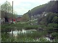
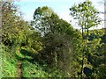
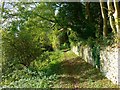
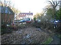
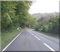


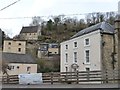
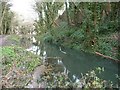
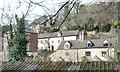
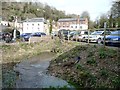
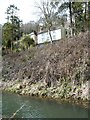
69 photos from this area
Area Information
Key information about the GL6 8PP including its size, population, and administrative classification.
- Area Type
- Postcode
- Area Size
- 2.4 hectares
- Population
- 1685
- Population Density
- 1073 people/km²
House Prices in GL6 8PP
16
Properties
£483,700
Average Sold Price
£250,000
Lowest Price
£975,000
Highest Price
Showing 16 properties
| Address | Type | Beds | Baths | Last Sale Price | Last Sale Date | |
|---|---|---|---|---|---|---|
| Woodbank Cottage, Old Neighbourhood, Chalford, Stroud, GL6 8PP | Detached | 2 | 1 | £325,000 | Jun 2023 | |
| Wickham Grange, London Road, Chalford, Stroud, GL6 8PP | Detached | 4 | - | £770,000 | Sep 2022 | |
| The Old Schoolhouse, Old Neighbourhood, Chalford, Stroud, GL6 8PP | Detached | - | - | £512,000 | Mar 2022 | |
| Beaufort House, London Road, Chalford, Stroud, GL6 8PP | Semi-detached | 4 | 1 | £335,000 | Apr 2021 | |
| Midhill, London Road To Old Neighbourhood Brimscombe, St Marys, Chalford, GL6 8PP | Semi-detached | 3 | - | £975,000 | Sep 2019 | |
| Wickham Cottage, London Road, Chalford, Stroud, GL6 8PP | house | 3 | - | £250,000 | Nov 2018 | |
| Mushroom Cottage, London Road To Old Neighbourhood Brimscombe, St Marys, Chalford, GL6 8PP | Detached | 4 | - | £385,000 | Feb 2015 | |
| West Wickham, London Road, Chalford, Stroud, GL6 8PP | house | 5 | - | £320,000 | Aug 2012 | |
| Sevillowes, Dark Lane, Chalford, Stroud, GL6 8PP | Detached | - | - | £650,000 | Jun 2006 | |
| Wickham House, London Road, Chalford, Stroud, GL6 8PP | house | - | - | £315,000 | Sep 2004 |
Page 1 of 2
Energy Efficiency in GL6 8PP
Amenities
Schools
| Rank | School | Type | Entry gender | Ages |
|---|
Explore more schools in this area
Go to Schools tabDemographics
Household Size
Two person
most common
Accommodation Type
Houses
most common
Tenure
93
majority
Ethnic Group
White
most common
Religion
N/A
most common
Household Composition
N/A
most common
Age
47
median
Adults (30-64 years)
most common
Household Deprivation
N/A
with no deprivation
NS-SEC
50
in Lower managerial occupations
Explore more demographic insights in this area
Go to Demographics tabPlanning
Planning Constraints
- Flood RiskPremium
- Ramsar Wetland SitesPremium
- Area of Outstanding Natural BeautyPremium
- Protected Nature ReservePremium
- Protected WoodlandPremium