Area Overview for GL6 8AS
Photos of GL6 8AS
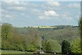
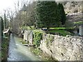
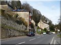
![Houses above the A419 [London Road] in GL6 8AS](https://images.propbar.co.uk/images/geograph/48/94/4894697_120.jpg)
35 photos from this area
Area Information
Key information about the GL6 8AS including its size, population, and administrative classification.
- Area Type
- Postcode
- Area Size
- 15.3 hectares
- Population
- 1685
- Population Density
- 1073 people/km²
House Prices in GL6 8AS
21
Properties
£396,389
Average Sold Price
£165,000
Lowest Price
£900,000
Highest Price
Showing 21 properties
| Address | Type | Beds | Baths | Last Sale Price | Last Sale Date | |
|---|---|---|---|---|---|---|
| Charnwood, Brownshill Road, Brownshill, Stroud, GL6 8AS | Detached | 3 | 1 | £600,000 | May 2023 | |
| Little House, Brownshill Road, Brownshill, Stroud, GL6 8AS | Detached | 4 | 2 | £707,000 | Mar 2023 | |
| Cedarwood, Brownshill Road, Brownshill, Stroud, GL6 8AS | Bungalow | 3 | - | £188,500 | Aug 2019 | |
| Bluebell Cottage, The Firs To Whitegates, Brownshill, Stroud, GL6 8AS | Terraced | 2 | 2 | £258,000 | Jul 2017 | |
| St Therese, St Marys Way, Brownshill, Stroud, GL6 8AS | house | - | - | £900,000 | Jul 2016 | |
| Marieham, The Firs To Whitegates, Brownshill, Stroud, GL6 8AS | Terraced | 4 | 3 | £375,000 | Apr 2011 | |
| High Timbers, Brownshill Road, Brownshill, Stroud, GL6 8AS | house | - | - | £194,000 | Sep 2006 | |
| The Cabin, Brownshill Road, Brownshill, Stroud, GL6 8AS | house | - | - | £180,000 | Jul 2002 | |
| Wayland Cottage, Brownshill Road, Brownshill, Stroud, GL6 8AS | Detached | - | - | £165,000 | Apr 1999 | |
| The Knoll, The Firs To Whitegates, Brownshill, Stroud, GL6 8AS | Terraced | 4 | 2 | - | - |
Page 1 of 3
Energy Efficiency in GL6 8AS
Amenities
Schools
| Rank | School | Type | Entry gender | Ages |
|---|
Explore more schools in this area
Go to Schools tabDemographics
Household Size
Two person
most common
Accommodation Type
Houses
most common
Tenure
93
majority
Ethnic Group
White
most common
Religion
N/A
most common
Household Composition
N/A
most common
Age
47
median
Adults (30-64 years)
most common
Household Deprivation
N/A
with no deprivation
NS-SEC
50
in Lower managerial occupations
Explore more demographic insights in this area
Go to Demographics tabPlanning
Planning Constraints
- Flood RiskPremium
- Ramsar Wetland SitesPremium
- Area of Outstanding Natural BeautyPremium
- Protected Nature ReservePremium
- Protected WoodlandPremium