Area Overview for GL6 6PE
Photos of GL6 6PE
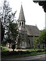

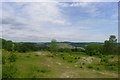
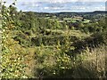
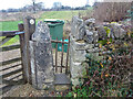
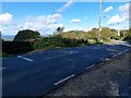
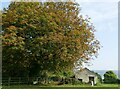
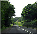
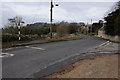
37 photos from this area
Area Information
Key information about the GL6 6PE including its size, population, and administrative classification.
- Area Type
- Postcode
- Area Size
- 3.1 hectares
- Population
- 1623
- Population Density
- 94 people/km²
House Prices in GL6 6PE
9
Properties
£689,356
Average Sold Price
£231,850
Lowest Price
£1,665,000
Highest Price
Showing 9 properties
| Address | Type | Beds | Baths | Last Sale Price | Last Sale Date | |
|---|---|---|---|---|---|---|
| Greystones, Back Edge Lane, Edge, Stroud, GL6 6PE | Bungalow | - | - | £575,000 | Feb 2025 | |
| Eastlea, Back Edge Lane, Edge, Stroud, GL6 6PE | house | 4 | 2 | £1,665,000 | Nov 2021 | |
| Wild Acre, Back Edge Lane, Edge, Stroud, GL6 6PE | Bungalow | - | - | £650,000 | Apr 2021 | |
| Chartwell, Back Edge Lane, Edge, Stroud, GL6 6PE | house | - | - | £735,000 | Mar 2021 | |
| Geldeston, Back Edge Lane, Edge, Stroud, GL6 6PE | Retail | 5 | 3 | £438,000 | Jan 2021 | |
| The Gate House, Back Edge Lane, Edge, Stroud, GL6 6PE | house | - | - | £500,000 | Nov 2013 | |
| Painswick View, Back Edge Lane, Edge, Stroud, GL6 6PE | house | - | - | £720,000 | Jul 2013 | |
| Rudge Cottage, Back Edge Lane, Edge, Stroud, GL6 6PE | Detached | 5 | 4 | £231,850 | Apr 1995 | |
| Boundary Cottage, Back Edge Lane, Edge, Stroud, GL6 6PE | Detached | 4 | - | - | - |
Energy Efficiency in GL6 6PE
Amenities
Schools
| Rank | School | Type | Entry gender | Ages |
|---|
Explore more schools in this area
Go to Schools tabDemographics
Household Size
Two person
most common
Accommodation Type
Houses
most common
Tenure
87
majority
Ethnic Group
White
most common
Religion
N/A
most common
Household Composition
N/A
most common
Age
47
median
Adults (30-64 years)
most common
Household Deprivation
N/A
with no deprivation
NS-SEC
56
in Lower managerial occupations
Explore more demographic insights in this area
Go to Demographics tabPlanning
Planning Constraints
- Flood RiskPremium
- Ramsar Wetland SitesPremium
- Area of Outstanding Natural BeautyPremium
- Protected Nature ReservePremium
- Protected WoodlandPremium