Area Overview for GL6 0AG
Photos of GL6 0AG

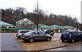
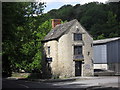


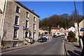

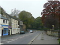

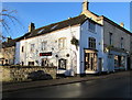
100 photos from this area
Area Information
Key information about the GL6 0AG including its size, population, and administrative classification.
- Area Type
- Postcode
- Area Size
- 2.2 hectares
- Population
- 1545
- Population Density
- 928 people/km²
House Prices in GL6 0AG
18
Properties
£372,500
Average Sold Price
£345,000
Lowest Price
£400,000
Highest Price
Showing 18 properties
| Address | Type | Beds | Baths | Last Sale Price | Last Sale Date | |
|---|---|---|---|---|---|---|
| Evergreen Cottage, George Street, Nailsworth, GL6 0AG | Terraced | - | - | £400,000 | Nov 2016 | |
| Stafford Lodge, George Street, Nailsworth, GL6 0AG | Semi-detached | 4 | - | £345,000 | Apr 2014 | |
| Millbank House, Millbank, George Street, Nailsworth, GL6 0AG | Detached | 3 | - | - | - | |
| Mill House, Millbank, George Street, Nailsworth, GL6 0AG | Detached | 4 | - | - | - | |
| 3, Millbank, George Street, Nailsworth, GL6 0AG | Detached | - | - | - | - | |
| Candlemill Cottage, Millbank, George Street, Nailsworth, GL6 0AG | Detached | - | - | - | - | |
| Hi Spirits Bar Co Ltd, Waterloo House, George Street, Nailsworth, GL6 0AG | Retail | - | - | - | - | |
| 4, Millbrook House, George Street, Nailsworth, GL6 0AG | retail_financial | - | - | - | - | |
| 3, Millbrook House, George Street, Nailsworth, GL6 0AG | Flat | - | - | - | - | |
| 2, Millbrook House, George Street, Nailsworth, GL6 0AG | Flat | - | - | - | - |
Page 1 of 2
Energy Efficiency in GL6 0AG
Amenities
Schools
| Rank | School | Type | Entry gender | Ages |
|---|
Explore more schools in this area
Go to Schools tabDemographics
Household Size
One person
most common
Accommodation Type
Houses
most common
Tenure
70
majority
Ethnic Group
White
most common
Religion
N/A
most common
Household Composition
N/A
most common
Age
47
median
Adults (30-64 years)
most common
Household Deprivation
N/A
with no deprivation
NS-SEC
49
in Lower managerial occupations
Explore more demographic insights in this area
Go to Demographics tabPlanning
Planning Constraints
- Flood RiskPremium
- Ramsar Wetland SitesPremium
- Area of Outstanding Natural BeautyPremium
- Protected Nature ReservePremium
- Protected WoodlandPremium