Area Overview for GL56 9PA
Photos of GL56 9PA
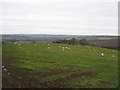


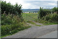


22 photos from this area
Area Information
Key information about the GL56 9PA including its size, population, and administrative classification.
- Area Type
- Postcode
- Area Size
- 64.1 hectares
- Population
- 1792
- Population Density
- 28 people/km²
House Prices in GL56 9PA
25
Properties
£882,361
Average Sold Price
£137,000
Lowest Price
£4,150,000
Highest Price
Showing 25 properties
| Address | Type | Beds | Baths | Last Sale Price | Last Sale Date | |
|---|---|---|---|---|---|---|
| Stonebank, Road From Todenham Road To A 3400, Todenham, GL56 9PA | house | - | - | £445,000 | May 2025 | |
| Bank Farmhouse, Road From Todenham Road To A 3400, Todenham, GL56 9PA | house | - | - | £4,150,000 | Mar 2025 | |
| 20 Road From Todenham Road To A 3400, Todenham, GL56 9PA | Semi-detached | 4 | 2 | £765,000 | Feb 2023 | |
| 9 Road From Todenham Road To A 3400, Todenham, GL56 9PA | house | - | - | £430,000 | Jun 2022 | |
| 2, Springbank, Road From Todenham Road To A 3400, Todenham, GL56 9PA | Semi-detached | 3 | 1 | £555,000 | Apr 2022 | |
| Todenham House, Road From Todenham Road To A 3400, Todenham, GL56 9PA | Cottage | 6 | 4 | £2,171,000 | Apr 2021 | |
| 11 Road From Todenham Road To A 3400, Todenham, GL56 9PA | Cottage | 2 | 1 | £305,000 | Mar 2020 | |
| Mulberry Cottage, 7 Road From Todenham Road To A 3400, Todenham, GL56 9PA | Detached | 4 | 2 | £1,150,000 | Mar 2019 | |
| Pilgrims Cottage, Road From Todenham Road To A 3400, Todenham, GL56 9PA | house | 3 | - | £500,000 | May 2014 | |
| 19 Road From Todenham Road To A 3400, Todenham, GL56 9PA | house | - | - | £422,500 | Oct 2010 |
Page 1 of 3
Energy Efficiency in GL56 9PA
Amenities
Schools
| Rank | School | Type | Entry gender | Ages |
|---|
Explore more schools in this area
Go to Schools tabDemographics
Household Size
Two person
most common
Accommodation Type
Houses
most common
Tenure
61
majority
Ethnic Group
White
most common
Religion
N/A
most common
Household Composition
N/A
most common
Age
47
median
Adults (30-64 years)
most common
Household Deprivation
N/A
with no deprivation
NS-SEC
41
in Lower managerial occupations
Explore more demographic insights in this area
Go to Demographics tabPlanning
Planning Constraints
- Flood RiskPremium
- Ramsar Wetland SitesPremium
- Area of Outstanding Natural BeautyPremium
- Protected Nature ReservePremium
- Protected WoodlandPremium