Area Overview for GL56 9HF
Photos of GL56 9HF


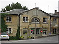
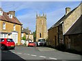
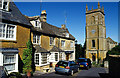
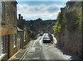
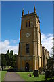
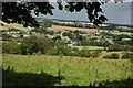
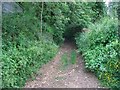


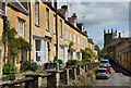
100 photos from this area
Area Information
Key information about the GL56 9HF including its size, population, and administrative classification.
- Area Type
- Postcode
- Area Size
- 3900 m²
- Population
- 1960
- Population Density
- 64 people/km²
House Prices in GL56 9HF
9
Properties
£578,600
Average Sold Price
£323,000
Lowest Price
£740,000
Highest Price
Showing 9 properties
| Address | Type | Beds | Baths | Last Sale Price | Last Sale Date | |
|---|---|---|---|---|---|---|
| HAWTHORNE COTTAGE, HIGH STREET, Blockley, GL56 9HF | Detached | 3 | 5 | £740,000 | Oct 2022 | |
| Garden Cottage, High Street, Blockley, GL56 9HF | house | - | - | £735,000 | Apr 2020 | |
| Chapel Cottage, High Street, Blockley, GL56 9HF | Cottage | 3 | 1 | £485,000 | Nov 2019 | |
| Tredwells, High Street, Blockley, GL56 9HF | Terraced | - | - | £610,000 | Jan 2017 | |
| Lansdowne, High Street, Blockley, GL56 9HF | Terraced | 2 | - | £323,000 | Jun 2011 | |
| Rose Cottage, High Street, Blockley, GL56 9HF | Terraced | 3 | 2 | - | - | |
| Middle Cottage, High Street, Blockley, GL56 9HF | Terraced | - | - | - | - | |
| Little Rose Cottage, High Street, Blockley, GL56 9HF | Terraced | - | - | - | - | |
| Pitt Cottage, High Street, Blockley, GL56 9HF | Terraced | - | - | - | - |
Energy Efficiency in GL56 9HF
Amenities
Schools
| Rank | School | Type | Entry gender | Ages |
|---|
Explore more schools in this area
Go to Schools tabDemographics
Household Size
Two person
most common
Accommodation Type
Houses
most common
Tenure
70
majority
Ethnic Group
White
most common
Religion
N/A
most common
Household Composition
N/A
most common
Age
47
median
Adults (30-64 years)
most common
Household Deprivation
N/A
with no deprivation
NS-SEC
40
in Lower managerial occupations
Explore more demographic insights in this area
Go to Demographics tabPlanning
Planning Constraints
- Flood RiskPremium
- Ramsar Wetland SitesPremium
- Area of Outstanding Natural BeautyPremium
- Protected Nature ReservePremium
- Protected WoodlandPremium