Area Overview for GL56 0XN
Photos of GL56 0XN
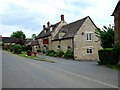
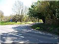
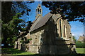
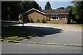
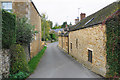
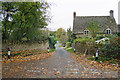
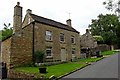

35 photos from this area
Area Information
Key information about the GL56 0XN including its size, population, and administrative classification.
- Area Type
- Postcode
- Area Size
- 8978 m²
- Population
- 1301
- Population Density
- 37 people/km²
House Prices in GL56 0XN
5
Properties
£502,500
Average Sold Price
£235,000
Lowest Price
£685,000
Highest Price
Showing 5 properties
| Address | Type | Beds | Baths | Last Sale Price | Last Sale Date | |
|---|---|---|---|---|---|---|
| Hillbrook House, Minor Road From Back Lane, Upper Oddington, GL56 0XN | Detached | 3 | 2 | £685,000 | Sep 2014 | |
| Top Cottage, Back Lane, Upper Oddington, GL56 0XN | Land | 5 | 5 | £685,000 | Oct 2009 | |
| Woodbine Cottage, Minor Road From Back Lane, Upper Oddington, GL56 0XN | Detached | - | - | £405,000 | Apr 2005 | |
| Pear Tree Cottage, Back Lane, Upper Oddington, GL56 0XN | Detached | 4 | 5 | £235,000 | Dec 1999 | |
| Oddington Top, Back Lane, Upper Oddington, GL56 0XN | Detached | 5 | 2 | - | - |
Energy Efficiency in GL56 0XN
Amenities
Schools
| Rank | School | Type | Entry gender | Ages |
|---|
Explore more schools in this area
Go to Schools tabDemographics
Household Size
Two person
most common
Accommodation Type
Houses
most common
Tenure
71
majority
Ethnic Group
White
most common
Religion
N/A
most common
Household Composition
N/A
most common
Age
47
median
Adults (30-64 years)
most common
Household Deprivation
N/A
with no deprivation
NS-SEC
42
in Lower managerial occupations
Explore more demographic insights in this area
Go to Demographics tabPlanning
Planning Constraints
- Flood RiskPremium
- Ramsar Wetland SitesPremium
- Area of Outstanding Natural BeautyPremium
- Protected Nature ReservePremium
- Protected WoodlandPremium