Area Overview for GL56 0QR
Photos of GL56 0QR
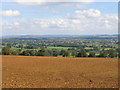
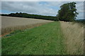
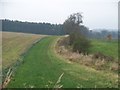
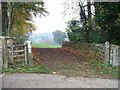
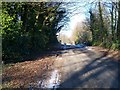
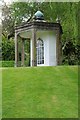
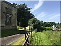
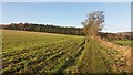
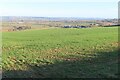
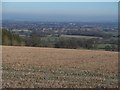
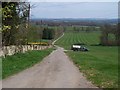
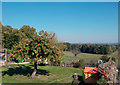
20 photos from this area
Area Information
Key information about the GL56 0QR including its size, population, and administrative classification.
- Area Type
- Postcode
- Area Size
- 72.4 hectares
- Population
- 1792
- Population Density
- 28 people/km²
House Prices in GL56 0QR
14
Properties
£481,250
Average Sold Price
£177,500
Lowest Price
£965,000
Highest Price
Showing 14 properties
| Address | Type | Beds | Baths | Last Sale Price | Last Sale Date | |
|---|---|---|---|---|---|---|
| Chapel Place, Chapel Lane, Longborough, GL56 0QR | Semi-detached | 2 | 2 | £340,000 | Jun 2022 | |
| Sunny Bank, Chapel Lane, Longborough, GL56 0QR | Detached | 4 | 2 | £965,000 | Nov 2019 | |
| Charlesway Cottage, Chapel Lane, Longborough, GL56 0QR | Detached | 4 | - | £655,000 | Dec 2014 | |
| Cherry Tree Cottage, Chapel Lane, Longborough, GL56 0QR | house | - | - | £320,000 | Mar 2012 | |
| Leeward, Chapel Lane, Longborough, GL56 0QR | house | - | - | £430,000 | Jul 2010 | |
| Greyfriars, Chapel Lane, Longborough, GL56 0QR | Detached | 3 | 3 | £177,500 | Jul 2000 | |
| Manor Farm, Chapel Lane, Longborough, GL56 0QR | Detached | - | - | - | - | |
| The Old Chapel, Chapel Lane, Longborough, GL56 0QR | Detached | 3 | 2 | - | - | |
| Rose Bank, Chapel Lane, Longborough, GL56 0QR | Detached | - | - | - | - | |
| Granary Cottage, Chapel Lane, Longborough, GL56 0QR | Semi-detached | - | - | - | - |
Page 1 of 2
Energy Efficiency in GL56 0QR
Amenities
Schools
| Rank | School | Type | Entry gender | Ages |
|---|
Explore more schools in this area
Go to Schools tabDemographics
Household Size
Two person
most common
Accommodation Type
Houses
most common
Tenure
61
majority
Ethnic Group
White
most common
Religion
N/A
most common
Household Composition
N/A
most common
Age
47
median
Adults (30-64 years)
most common
Household Deprivation
N/A
with no deprivation
NS-SEC
41
in Lower managerial occupations
Explore more demographic insights in this area
Go to Demographics tabPlanning
Planning Constraints
- Flood RiskPremium
- Ramsar Wetland SitesPremium
- Area of Outstanding Natural BeautyPremium
- Protected Nature ReservePremium
- Protected WoodlandPremium