Area Overview for GL56 0QF
Photos of GL56 0QF
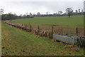
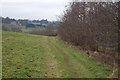


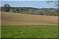

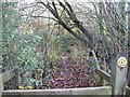


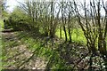
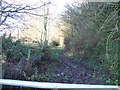

13 photos from this area
Area Information
Key information about the GL56 0QF including its size, population, and administrative classification.
- Area Type
- Postcode
- Area Size
- 1.1 km²
- Population
- 1792
- Population Density
- 28 people/km²
House Prices in GL56 0QF
23
Properties
£475,531
Average Sold Price
£190,000
Lowest Price
£1,200,000
Highest Price
Showing 23 properties
| Address | Type | Beds | Baths | Last Sale Price | Last Sale Date | |
|---|---|---|---|---|---|---|
| 8 Old Rectory Gardens, Longborough, GL56 0QF | Detached | 3 | 2 | £555,000 | Dec 2023 | |
| Burntwood, 2 Old Rectory Gardens, Longborough, GL56 0QF | Semi-detached | - | - | £485,000 | Dec 2021 | |
| Milverton, Old Rectory Gardens, Longborough, GL56 0QF | house | - | - | £1,200,000 | Sep 2021 | |
| Banks Fee Lodge, Banks Fee Lane, Longborough, GL56 0QF | Semi-detached | - | - | £550,000 | Jun 2021 | |
| Greyes, Old Rectory Gardens, Longborough, GL56 0QF | house | - | - | £515,000 | Dec 2018 | |
| 3, The Old Rectory, Old Rectory Gardens, Longborough, GL56 0QF | Terraced | - | - | £435,000 | Mar 2018 | |
| Four Winds, Old Rectory Gardens, Longborough, GL56 0QF | house | - | - | £425,000 | Jun 2017 | |
| The Rectory, 4/577 Jnct A 424 To Longborough, Longborough, GL56 0QF | house | - | - | £900,000 | Oct 2012 | |
| Walnut Cottage, 7 Old Rectory Gardens, Longborough, GL56 0QF | Detached | 3 | - | £332,500 | Dec 2010 | |
| 4, The Old Rectory, Old Rectory Gardens, Longborough, GL56 0QF | Terraced | - | - | £450,000 | Oct 2008 |
Page 1 of 3
Energy Efficiency in GL56 0QF
Amenities
Schools
| Rank | School | Type | Entry gender | Ages |
|---|
Explore more schools in this area
Go to Schools tabDemographics
Household Size
Two person
most common
Accommodation Type
Houses
most common
Tenure
61
majority
Ethnic Group
White
most common
Religion
N/A
most common
Household Composition
N/A
most common
Age
47
median
Adults (30-64 years)
most common
Household Deprivation
N/A
with no deprivation
NS-SEC
41
in Lower managerial occupations
Explore more demographic insights in this area
Go to Demographics tabPlanning
Planning Constraints
- Flood RiskPremium
- Ramsar Wetland SitesPremium
- Area of Outstanding Natural BeautyPremium
- Protected Nature ReservePremium
- Protected WoodlandPremium