Area Overview for GL56 0EY
Photos of GL56 0EY
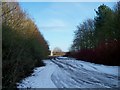
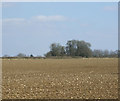
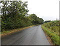

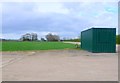
11 photos from this area
Area Information
Key information about the GL56 0EY including its size, population, and administrative classification.
- Area Type
- Postcode
- Area Size
- 3.7 hectares
- Population
- 1771
- Population Density
- 1138 people/km²
House Prices in GL56 0EY
48
Properties
£314,874
Average Sold Price
£128,000
Lowest Price
£570,000
Highest Price
Showing 48 properties
| Address | Type | Beds | Baths | Last Sale Price | Last Sale Date | |
|---|---|---|---|---|---|---|
| 25 Windsor Road, Moreton In Marsh, GL56 0EY | house | - | - | £132,000 | Nov 2025 | |
| 29 Windsor Road, Moreton In Marsh, GL56 0EY | Terraced | 2 | 2 | £128,000 | Dec 2024 | |
| 43 Windsor Road, Moreton In Marsh, GL56 0EY | Semi-detached | 4 | 1 | £302,750 | Aug 2024 | |
| 13 Windsor Road, Moreton In Marsh, GL56 0EY | Flat | 1 | 1 | £395,000 | Dec 2023 | |
| 15 Windsor Road, Moreton In Marsh, GL56 0EY | Semi-detached | 3 | 2 | £370,000 | Aug 2023 | |
| 41 Windsor Road, Moreton In Marsh, GL56 0EY | house | - | - | £281,750 | May 2023 | |
| 33 Windsor Road, Moreton In Marsh, GL56 0EY | house | - | - | £232,750 | Feb 2023 | |
| 65 Windsor Road, Moreton In Marsh, GL56 0EY | house | - | - | £440,000 | Sep 2020 | |
| 63 Windsor Road, Moreton In Marsh, GL56 0EY | house | - | - | £345,000 | Sep 2020 | |
| 61 Windsor Road, Moreton In Marsh, GL56 0EY | house | - | - | £275,000 | Sep 2020 |
Page 1 of 5
Energy Efficiency in GL56 0EY
Amenities
Schools
| Rank | School | Type | Entry gender | Ages |
|---|
Explore more schools in this area
Go to Schools tabDemographics
Household Size
Family (3-5 people)
most common
Accommodation Type
Houses
most common
Tenure
61
majority
Ethnic Group
White
most common
Religion
N/A
most common
Household Composition
N/A
most common
Age
47
median
Adults (30-64 years)
most common
Household Deprivation
N/A
with no deprivation
NS-SEC
42
in Lower managerial occupations
Explore more demographic insights in this area
Go to Demographics tabPlanning
Planning Constraints
- Flood RiskPremium
- Ramsar Wetland SitesPremium
- Area of Outstanding Natural BeautyPremium
- Protected Nature ReservePremium
- Protected WoodlandPremium