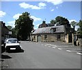
Area Overview for GL56 0AY
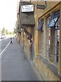
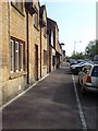
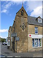
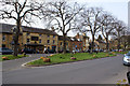
Photos of GL56 0AY
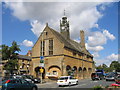
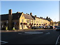

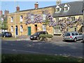
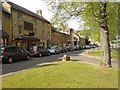


Area Information
Living in GL56 0AY means inhabiting a tightly packed residential cluster in England, where 1,946 people reside across 500 square metres. This small postcode area, with a population density of 1,618 people per square kilometre, reflects a compact, closely knit community. Daily life here is shaped by proximity to local amenities and a demographic skewed towards adults aged 30–64, with a median age of 47. The area’s housing stock is predominantly owner-occupied, with 62% of homes owned by residents, suggesting a stable, long-term community. While the area lacks sprawling landscapes or major infrastructure, its proximity to retail and rail connections makes it practical for everyday needs. However, the high population density means space is limited, and buyers should consider the small scale of the area when exploring nearby options. GL56 0AY is not a sprawling suburb but a defined cluster, where neighbours are likely to be familiar faces.
- Area Type
- Postcode
- Area Size
- 500 m²
- Population
- 1946
- Population Density
- 1618 people/km²
The property market in GL56 0AY is defined by a high rate of home ownership—62% of residents own their homes—suggesting a community where long-term residency is common. The area is dominated by houses rather than flats or apartments, which may appeal to buyers seeking family-friendly or spacious properties. Given the small size of the postcode area, the housing stock is limited, and buyers may need to look beyond GL56 0AY itself to find options. The compact nature of the area means properties are likely to be close to each other, with limited scope for expansion. For those prioritising proximity to amenities, the nearby retail outlets and rail access to Moreton station add practical value. However, the lack of large-scale development or new builds may mean the market is static, with prices influenced more by location and condition than by new supply.
House Prices in GL56 0AY
No properties found in this postcode.
Energy Efficiency in GL56 0AY
Residents of GL56 0AY have access to a modest but functional range of amenities. The area includes five retail outlets, such as Co-op Moreton in, Asda Marsh, and Aldi Moreton-in, providing everyday shopping options. The nearby Moreton rail station connects to broader regional networks, offering convenience for commuters. However, the data does not mention parks, leisure facilities, or dining options, suggesting that the area’s lifestyle is focused on practicality rather than recreation. For those prioritising retail and transport, GL56 0AY offers sufficient proximity to basic needs. The absence of detailed information on leisure or green spaces means buyers should consider whether the area’s character aligns with their preferences for outdoor activities or social venues. The compact nature of the area ensures that amenities are within walking distance, though the selection remains limited.
Amenities
Schools
The nearest school to GL56 0AY is Dormer House School, an independent institution. Independent schools typically charge fees and may offer specialised curricula or smaller class sizes, though no Ofsted rating is provided in the data. Families seeking state education would need to look beyond the immediate area, as no other schools are listed. The presence of a single independent school suggests that GL56 0AY may cater to households prioritising private education. For those relying on state schools, the area’s limited options could be a consideration, particularly for parents seeking a range of educational choices. The absence of data on school performance or capacity means prospective buyers should investigate further to assess whether Dormer House meets their needs or if additional schooling options are required.
| Rank | School | Type | Entry gender | Ages |
|---|
Explore more schools in this area
Go to Schools tabDemographics
The community in GL56 0AY is predominantly composed of adults aged 30–64, with a median age of 47. This suggests a mature population, likely with established careers and families. Home ownership is strong, with 62% of residents owning their homes, compared to 38% renting. The area is characterised by houses rather than flats or apartments, reflecting a traditional housing stock. The predominant ethnic group is White, though no specific data on diversity or deprivation is provided. The high population density of 1,618 people per square kilometre indicates a compact, possibly multi-generational living environment. For buyers, this suggests a community that values stability and long-term residency over transient living. The absence of specific data on deprivation means assumptions about quality of life must be cautious, but the demographics point to a settled, middle-aged population with established routines and local ties.
Household Size
Accommodation Type
Tenure
Ethnic Group
Religion
Household Composition
Age
Household Deprivation
NS-SEC
Explore more demographic insights in this area
Go to Demographics tabPlanning
Planning Constraints
- Flood RiskPremium
- Ramsar Wetland SitesPremium
- Area of Outstanding Natural BeautyPremium
- Protected Nature ReservePremium
- Protected WoodlandPremium