Area Overview for GL55 6SJ
Photos of GL55 6SJ
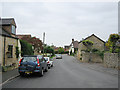
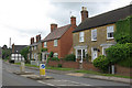
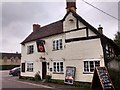
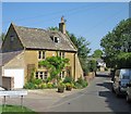
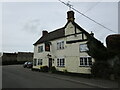
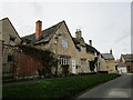
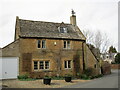
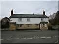
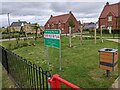
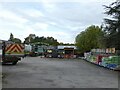
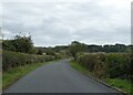
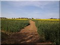
34 photos from this area
Area Information
Key information about the GL55 6SJ including its size, population, and administrative classification.
- Area Type
- Postcode
- Area Size
- 2.4 hectares
- Population
- 1965
- Population Density
- 402 people/km²
House Prices in GL55 6SJ
24
Properties
£457,808
Average Sold Price
£295,000
Lowest Price
£740,000
Highest Price
Showing 24 properties
| Address | Type | Beds | Baths | Last Sale Price | Last Sale Date | |
|---|---|---|---|---|---|---|
| The Old School Hall, Back Lane, Mickleton, GL55 6SJ | house | - | - | £625,000 | Oct 2023 | |
| Chelsea Gardens, Back Lane, Mickleton, GL55 6SJ | house | - | - | £432,000 | Dec 2021 | |
| The Cottage, Back Lane, Mickleton, GL55 6SJ | Detached | 3 | - | £480,000 | Mar 2021 | |
| Spring Cottage, Back Lane, Mickleton, GL55 6SJ | Detached | 3 | - | £430,000 | Dec 2015 | |
| Brownswood, Back Lane, Mickleton, GL55 6SJ | Bungalow | 3 | - | £320,000 | Dec 2014 | |
| Walnut View, Back Lane, Mickleton, GL55 6SJ | Detached | 4 | - | £422,500 | Dec 2014 | |
| Cherry Orchard, Back Lane, Mickleton, GL55 6SJ | house | 5 | 4 | £572,000 | Mar 2012 | |
| Little Tudor, Back Lane, Mickleton, GL55 6SJ | house | - | - | £385,000 | Jan 2011 | |
| Camber House, Back Lane, Mickleton, GL55 6SJ | Detached | - | - | £420,000 | Oct 2005 | |
| Kite House, Back Lane, Mickleton, GL55 6SJ | Detached | 5 | 2 | £345,000 | Jul 2005 |
Page 1 of 3
Energy Efficiency in GL55 6SJ
Amenities
Schools
| Rank | School | Type | Entry gender | Ages |
|---|
Explore more schools in this area
Go to Schools tabDemographics
Household Size
Two person
most common
Accommodation Type
Houses
most common
Tenure
72
majority
Ethnic Group
White
most common
Religion
N/A
most common
Household Composition
N/A
most common
Age
47
median
Adults (30-64 years)
most common
Household Deprivation
N/A
with no deprivation
NS-SEC
40
in Lower managerial occupations
Explore more demographic insights in this area
Go to Demographics tabPlanning
Planning Constraints
- Flood RiskPremium
- Ramsar Wetland SitesPremium
- Area of Outstanding Natural BeautyPremium
- Protected Nature ReservePremium
- Protected WoodlandPremium