Area Overview for GL55 6RX
Photos of GL55 6RX
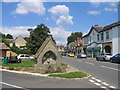
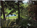
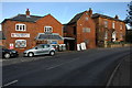
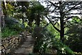
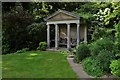
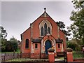
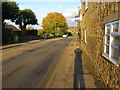
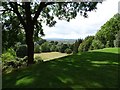
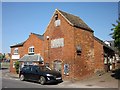
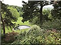
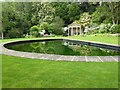
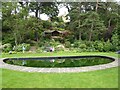
78 photos from this area
Area Information
Key information about the GL55 6RX including its size, population, and administrative classification.
- Area Type
- Postcode
- Area Size
- 1.2 hectares
- Population
- 1965
- Population Density
- 402 people/km²
House Prices in GL55 6RX
21
Properties
£229,333
Average Sold Price
£153,000
Lowest Price
£350,000
Highest Price
Showing 21 properties
| Address | Type | Beds | Baths | Last Sale Price | Last Sale Date | |
|---|---|---|---|---|---|---|
| The Old Bank, High Street, Mickleton, GL55 6RX | house | - | - | £350,000 | Jan 2020 | |
| The Croft, High Street, Mickleton, GL55 6RX | Detached | - | - | £153,000 | Mar 2001 | |
| Medford Cottage, High Street, Mickleton, GL55 6RX | house | - | - | £185,000 | Apr 1998 | |
| Garden Cottage, Mickleton House, High Street, Mickleton, GL55 6RX | Bungalow | 2 | 1 | - | - | |
| Yew Tree View, Mickleton House, High Street, Mickleton, GL55 6RX | Flat | 2 | 2 | - | - | |
| Kalmia Cottage, Mickleton House, High Street, Mickleton, GL55 6RX | Terraced | 3 | 1 | - | - | |
| 2-3, Elder Villa, High Street, Mickleton, GL55 6RX | Semi-detached | 4 | 3 | - | - | |
| Birch View, Mickleton House, High Street, Mickleton, GL55 6RX | Maisonette | 2 | 1 | - | - | |
| Holly Cottage, Mickleton House, High Street, Mickleton, GL55 6RX | Terraced | 2 | - | - | - | |
| Gorse Cottage, Mickleton House, High Street, Mickleton, GL55 6RX | Terraced | 2 | - | - | - |
Page 1 of 3
Energy Efficiency in GL55 6RX
Amenities
Schools
| Rank | School | Type | Entry gender | Ages |
|---|
Explore more schools in this area
Go to Schools tabDemographics
Household Size
Two person
most common
Accommodation Type
Houses
most common
Tenure
72
majority
Ethnic Group
White
most common
Religion
N/A
most common
Household Composition
N/A
most common
Age
47
median
Adults (30-64 years)
most common
Household Deprivation
N/A
with no deprivation
NS-SEC
40
in Lower managerial occupations
Explore more demographic insights in this area
Go to Demographics tabPlanning
Planning Constraints
- Flood RiskPremium
- Ramsar Wetland SitesPremium
- Area of Outstanding Natural BeautyPremium
- Protected Nature ReservePremium
- Protected WoodlandPremium