Area Overview for GL55 6HR
Photos of GL55 6HR


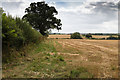

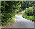
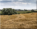

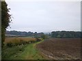
30 photos from this area
Area Information
Key information about the GL55 6HR including its size, population, and administrative classification.
- Area Type
- Postcode
- Area Size
- 53.3 hectares
- Population
- 1539
- Population Density
- 634 people/km²
House Prices in GL55 6HR
34
Properties
£734,880
Average Sold Price
£200,000
Lowest Price
£1,450,000
Highest Price
Showing 34 properties
| Address | Type | Beds | Baths | Last Sale Price | Last Sale Date | |
|---|---|---|---|---|---|---|
| Garrah Lodge, Aston Road, Chipping Campden, GL55 6HR | house | 5 | 4 | £935,000 | Oct 2024 | |
| Marleys, Aston Road, Chipping Campden, GL55 6HR | house | - | - | £770,000 | Aug 2024 | |
| Lower Kingcombe, Aston Road, Chipping Campden, GL55 6HR | Detached | 4 | 3 | £1,195,000 | Jul 2023 | |
| 6 Aston Road, Chipping Campden, GL55 6HR | house | - | - | £935,000 | Apr 2023 | |
| Hope House, Aston Road, Chipping Campden, GL55 6HR | house | - | - | £825,000 | Mar 2023 | |
| Wolds End House, 8 Aston Road, Chipping Campden, GL55 6HR | house | - | - | £750,000 | May 2022 | |
| Astonia, Aston Road, Chipping Campden, GL55 6HR | house | - | - | £890,000 | Mar 2021 | |
| Ellesmere House, Aston Road, Chipping Campden, GL55 6HR | Detached | 4 | 4 | £725,000 | Dec 2020 | |
| Highclere, Aston Road, Chipping Campden, GL55 6HR | Detached | 6 | 3 | £695,000 | Aug 2018 | |
| Churchill, Aston Road, Chipping Campden, GL55 6HR | house | - | - | £700,000 | Jun 2018 |
Page 1 of 4
Energy Efficiency in GL55 6HR
Amenities
Schools
| Rank | School | Type | Entry gender | Ages |
|---|
Explore more schools in this area
Go to Schools tabDemographics
Household Size
Two person
most common
Accommodation Type
Houses
most common
Tenure
70
majority
Ethnic Group
White
most common
Religion
N/A
most common
Household Composition
N/A
most common
Age
47
median
Adults (30-64 years)
most common
Household Deprivation
N/A
with no deprivation
NS-SEC
44
in Lower managerial occupations
Explore more demographic insights in this area
Go to Demographics tabPlanning
Planning Constraints
- Flood RiskPremium
- Ramsar Wetland SitesPremium
- Area of Outstanding Natural BeautyPremium
- Protected Nature ReservePremium
- Protected WoodlandPremium