Area Overview for GL55 6DY
Photos of GL55 6DY

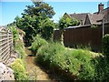

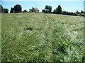
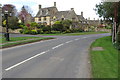
![Grassy field [1] in GL55 6DY](https://images.propbar.co.uk/images/geograph/19/51/1951005_120.jpg)
55 photos from this area
Area Information
Key information about the GL55 6DY including its size, population, and administrative classification.
- Area Type
- Postcode
- Area Size
- 5678 m²
- Population
- 1539
- Population Density
- 634 people/km²
House Prices in GL55 6DY
20
Properties
£489,833
Average Sold Price
£187,000
Lowest Price
£715,000
Highest Price
Showing 20 properties
| Address | Type | Beds | Baths | Last Sale Price | Last Sale Date | |
|---|---|---|---|---|---|---|
| 17, St Catherines Square, Lower High Street, Chipping Campden, GL55 6DY | house | - | - | £665,000 | Dec 2024 | |
| 18, St Catherines Square, Lower High Street, Chipping Campden, GL55 6DY | house | - | - | £560,000 | Nov 2023 | |
| 15 Lower High Street, Chipping Campden, GL55 6DY | Terraced | - | - | £379,000 | Mar 2021 | |
| Scotts Cottage, Lower High Street, Chipping Campden, GL55 6DY | house | 2 | 2 | £332,500 | Oct 2020 | |
| Harrow House, Lower High Street, Chipping Campden, GL55 6DY | Terraced | - | - | £715,000 | Feb 2018 | |
| Butchers House, Lower High Street, Chipping Campden, GL55 6DY | house | 4 | - | £680,000 | Jun 2014 | |
| Frances Cottage, Lower High Street, Chipping Campden, GL55 6DY | Terraced | 3 | 1 | £490,000 | Dec 2013 | |
| Izods Cottage, Lower High Street, Chipping Campden, GL55 6DY | Terraced | - | - | £400,000 | May 2012 | |
| Francote, Lower High Street, Chipping Campden, GL55 6DY | Terraced | 3 | 2 | £187,000 | Jun 2002 | |
| 1, Broad Entry, Lower High Street, Chipping Campden, GL55 6DY | Terraced | 2 | 1 | - | - |
Page 1 of 2
Energy Efficiency in GL55 6DY
Amenities
Schools
| Rank | School | Type | Entry gender | Ages |
|---|
Explore more schools in this area
Go to Schools tabDemographics
Household Size
Two person
most common
Accommodation Type
Houses
most common
Tenure
70
majority
Ethnic Group
White
most common
Religion
N/A
most common
Household Composition
N/A
most common
Age
47
median
Adults (30-64 years)
most common
Household Deprivation
N/A
with no deprivation
NS-SEC
44
in Lower managerial occupations
Explore more demographic insights in this area
Go to Demographics tabPlanning
Planning Constraints
- Flood RiskPremium
- Ramsar Wetland SitesPremium
- Area of Outstanding Natural BeautyPremium
- Protected Nature ReservePremium
- Protected WoodlandPremium