Area Overview for GL55 6DE
Photos of GL55 6DE

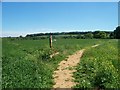
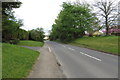
![Path to Broad Campden [1] in GL55 6DE](https://images.propbar.co.uk/images/geograph/19/51/1951026_120.jpg)
33 photos from this area
Area Information
Key information about the GL55 6DE including its size, population, and administrative classification.
- Area Type
- Postcode
- Area Size
- 6.2 hectares
- Population
- 1544
- Population Density
- 52 people/km²
House Prices in GL55 6DE
11
Properties
£604,667
Average Sold Price
£410,000
Lowest Price
£1,000,000
Highest Price
Showing 11 properties
| Address | Type | Beds | Baths | Last Sale Price | Last Sale Date | |
|---|---|---|---|---|---|---|
| Catbrook House, Catbrook, Chipping Campden, GL55 6DE | house | - | - | £1,000,000 | Mar 2024 | |
| Tunstall, Catbrook, Chipping Campden, GL55 6DE | Detached | 4 | 1 | £555,000 | Oct 2017 | |
| Catbrook Furlong, Catbrook, Chipping Campden, GL55 6DE | Detached | 4 | 3 | £660,000 | Sep 2017 | |
| The Honeycombe, Catbrook, Chipping Campden, GL55 6DE | Bungalow | 3 | 2 | £410,000 | Feb 2016 | |
| Furlong Cottage, Catbrook, Chipping Campden, GL55 6DE | Detached | 4 | 3 | £590,000 | Jun 2014 | |
| Sundown, Catbrook, Chipping Campden, GL55 6DE | house | - | - | £413,000 | Oct 2009 | |
| Wold Furlong, Catbrook, Chipping Campden, GL55 6DE | Detached | 6 | 4 | - | - | |
| Garage Flat, Wold Furlong, Catbrook, Chipping Campden, GL55 6DE | Flat | - | - | - | - | |
| Bumble Bee Cottage, Catbrook, Chipping Campden, GL55 6DE | Semi-detached | - | - | - | - | |
| Beehive, Catbrook, Chipping Campden, GL55 6DE | Detached | - | - | - | - |
Page 1 of 2
Energy Efficiency in GL55 6DE
Amenities
Schools
| Rank | School | Type | Entry gender | Ages |
|---|
Explore more schools in this area
Go to Schools tabDemographics
Household Size
Two person
most common
Accommodation Type
Houses
most common
Tenure
69
majority
Ethnic Group
White
most common
Religion
N/A
most common
Household Composition
N/A
most common
Age
47
median
Adults (30-64 years)
most common
Household Deprivation
N/A
with no deprivation
NS-SEC
45
in Lower managerial occupations
Explore more demographic insights in this area
Go to Demographics tabPlanning
Planning Constraints
- Flood RiskPremium
- Ramsar Wetland SitesPremium
- Area of Outstanding Natural BeautyPremium
- Protected Nature ReservePremium
- Protected WoodlandPremium