Area Overview for GL54 5BB
Photos of GL54 5BB
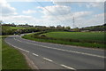

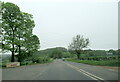
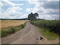
![Footpath through Postlip Mill [1] in GL54 5BB](https://images.propbar.co.uk/images/geograph/25/33/2533565_120.jpg)

Area Information
Living in GL54 5BB offers a quiet, compact residential experience in England’s countryside. This small postcode area spans 15.2 hectares, home to 1,785 residents spread across a population density of 79 people per square kilometre. The community is defined by its low-key charm, with a median age of 47 and a majority of residents aged 30–64. Most homes are owner-occupied, with 84% of properties owned outright, reflecting a stable, long-term population. The area’s proximity to Winchcombe and nearby towns ensures easy access to services without compromising the tranquillity of rural living. Daily life here is characterised by a balance between local amenities and the surrounding natural landscape, with minimal environmental constraints. Safety is a key feature, with low flood risk and below-average crime rates, making it an attractive option for those seeking a secure, low-maintenance lifestyle.
- Area Type
- Postcode
- Area Size
- 15.2 hectares
- Population
- 1785
- Population Density
- 79 people/km²
The property market in GL54 5BB is predominantly owner-occupied, with 84% of homes owned by their residents. This reflects a community focused on long-term living rather than rental turnover. The accommodation type is largely houses, which is typical for rural and semi-rural areas with low population density. The small size of the postcode area means the housing stock is limited, but the surrounding region offers nearby options for buyers seeking similar properties. For those considering GL54 5BB, the emphasis on owner-occupied homes suggests a stable market with fewer speculative investments. However, the limited number of properties also means competition may be higher for desirable homes. Buyers should consider the immediate surroundings for additional options, as the area’s compact nature restricts expansion.
House Prices in GL54 5BB
Showing 1 properties
| Address | Type | Beds | Baths | Last Sale Price | Last Sale Date | |
|---|---|---|---|---|---|---|
| Hollingsworth And Vose Co Ltd, Postlip, Winchcombe, Cheltenham, GL54 5BB | Detached | - | - | - | - |
Energy Efficiency in GL54 5BB
Life in GL54 5BB is shaped by its proximity to essential amenities within practical reach. The retail sector includes Morrisons Daily, Co-op Winchcombe, and Co-op Bishops, providing grocery and daily shopping options. Metro stations at Winchcombe, Gotherington, and Cheltenham Racecourse, along with the Cheltenham Spa Railway Station, ensure access to regional transport. The area’s low population density and rural setting mean that these amenities are close enough to support a convenient lifestyle without the need for long commutes. The presence of multiple schools, combined with accessible retail and transport, creates a self-contained environment where daily needs are met locally. This balance of practicality and tranquillity defines the character of GL54 5BB.
Amenities
Schools
Residents of GL54 5BB have access to several primary schools, including Gretton Primary School and Oak Hill Church of England Primary School, both of which are rated ‘satisfactory’ and ‘good’ by Ofsted, respectively. Winchcombe School serves as both a primary and academy, with its academy status indicating a focus on independent governance and potentially higher standards. The presence of multiple schools, including a rated ‘good’ academy, provides families with choice and flexibility. The mix of traditional and academy schools suggests a range of educational approaches, from community-focused to more structured, performance-driven models. For parents, this diversity ensures options that align with their priorities, whether they value established local institutions or academies with distinct curricula.
| Rank | School | Type | Entry gender | Ages |
|---|
Explore more schools in this area
Go to Schools tabDemographics
The demographic profile of GL54 5BB is shaped by its adult population, with 84% of residents owning their homes. The majority of properties are houses, not flats, which aligns with the area’s low population density of 79 people per square kilometre. The median age of 47 suggests a community of established residents, with the most common age range being 30–64 years. The predominant ethnic group is White, reflecting the area’s rural character and limited diversity. Home ownership is high, indicating a stable, long-term population with little turnover. This combination of age, ownership, and housing type creates a cohesive, settled community. While the data does not provide specific figures on deprivation, the low crime risk and lack of environmental constraints suggest a quality of life that is generally secure and unburdened by external pressures.
Household Size
Accommodation Type
Tenure
Ethnic Group
Religion
Household Composition
Age
Household Deprivation
NS-SEC
Explore more demographic insights in this area
Go to Demographics tabPlanning
Planning Constraints
- Flood RiskPremium
- Ramsar Wetland SitesPremium
- Area of Outstanding Natural BeautyPremium
- Protected Nature ReservePremium
- Protected WoodlandPremium