Area Overview for GL54 4DP
Photos of GL54 4DP
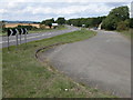


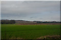
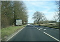

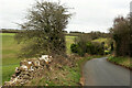
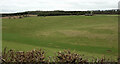
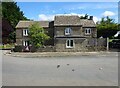
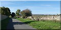
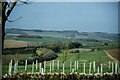

22 photos from this area
Area Information
Key information about the GL54 4DP including its size, population, and administrative classification.
- Area Type
- Postcode
- Area Size
- 21.0 hectares
- Population
- 1629
- Population Density
- 24 people/km²
House Prices in GL54 4DP
9
Properties
£786,957
Average Sold Price
£116,100
Lowest Price
£2,807,602
Highest Price
Showing 9 properties
| Address | Type | Beds | Baths | Last Sale Price | Last Sale Date | |
|---|---|---|---|---|---|---|
| Manor Farm, Road From Compton Abdale To Compton Farm, Compton Abdale, GL54 4DP | house | - | - | £2,807,602 | Oct 2021 | |
| 2, Upper Cottages, Road From Compton Abdale To Compton Farm, Compton Abdale, GL54 4DP | Cottage | 2 | 1 | £315,000 | Sep 2021 | |
| Hill View, Road From Compton Abdale To Compton Farm, Compton Abdale, GL54 4DP | Detached | 4 | 2 | £770,000 | May 2019 | |
| Easter Cottage, Road From Compton Abdale To Compton Farm, Compton Abdale, GL54 4DP | Cottage | 3 | - | £520,000 | Oct 2015 | |
| The Orchard House, Pike Hill Rise, Compton Abdale, GL54 4DP | house | 6 | - | £850,000 | Oct 2009 | |
| 1, Upper Cottages, Road From Compton Abdale To Compton Farm, Compton Abdale, GL54 4DP | Terraced | - | - | £116,100 | Oct 2002 | |
| Yew Tree Cottage, Road From Compton Abdale To Compton Farm, Compton Abdale, GL54 4DP | Terraced | - | - | £130,000 | Jun 2001 | |
| 3, Mulberry Cottage, Upper Cottages, Road From Compton Abdale To Compton Farm, Compton Abdale, GL54 4DP | Cottage | 2 | 1 | - | - | |
| The Owl Barn, Manor Farm, Road From Compton Abdale To Compton Farm, Compton Abdale, GL54 4DP | Detached | 4 | 3 | - | - |
Energy Efficiency in GL54 4DP
Amenities
Schools
| Rank | School | Type | Entry gender | Ages |
|---|
Explore more schools in this area
Go to Schools tabDemographics
Household Size
Two person
most common
Accommodation Type
Houses
most common
Tenure
71
majority
Ethnic Group
White
most common
Religion
N/A
most common
Household Composition
N/A
most common
Age
47
median
Adults (30-64 years)
most common
Household Deprivation
N/A
with no deprivation
NS-SEC
46
in Lower managerial occupations
Explore more demographic insights in this area
Go to Demographics tabPlanning
Planning Constraints
- Flood RiskPremium
- Ramsar Wetland SitesPremium
- Area of Outstanding Natural BeautyPremium
- Protected Nature ReservePremium
- Protected WoodlandPremium