Area Overview for GL54 4AG
Photos of GL54 4AG
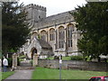
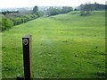
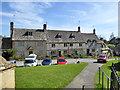
![A circular walk around Chedworth [65] in GL54 4AG](https://images.propbar.co.uk/images/geograph/63/78/6378409_120.jpg)
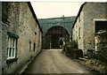
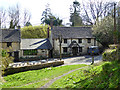
![Chedworth buildings [1] in GL54 4AG](https://images.propbar.co.uk/images/geograph/63/79/6379739_120.jpg)
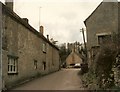
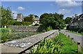
![Chedworth houses [1] in GL54 4AG](https://images.propbar.co.uk/images/geograph/63/79/6379743_120.jpg)
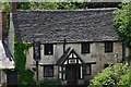
![Chedworth houses [2] in GL54 4AG](https://images.propbar.co.uk/images/geograph/63/79/6379744_120.jpg)
100 photos from this area
Area Information
Key information about the GL54 4AG including its size, population, and administrative classification.
- Area Type
- Postcode
- Area Size
- 24.3 hectares
- Population
- 1629
- Population Density
- 24 people/km²
House Prices in GL54 4AG
21
Properties
£650,729
Average Sold Price
£112,750
Lowest Price
£1,450,000
Highest Price
Showing 21 properties
| Address | Type | Beds | Baths | Last Sale Price | Last Sale Date | |
|---|---|---|---|---|---|---|
| Willow Tree Cottage, Queen Street, Chedworth, GL54 4AG | house | 2 | - | £860,000 | Jan 2025 | |
| The Old Bakery, Queen Street, Chedworth, GL54 4AG | house | 5 | 3 | £1,215,000 | Sep 2024 | |
| Laurence Cottage, Queen Street, Chedworth, GL54 4AG | house | 3 | 1 | £655,000 | May 2022 | |
| The West House, Queen Street, Chedworth, GL54 4AG | Retail | 3 | 2 | £725,000 | Mar 2022 | |
| Buttress House, Queen Street, Chedworth, GL54 4AG | Detached | 5 | 4 | £1,450,000 | Mar 2019 | |
| Adams Pool, Queen Street, Chedworth, GL54 4AG | house | - | - | £725,000 | Sep 2011 | |
| Laurel Cottage, Queen Street, Chedworth, GL54 4AG | house | 4 | 4 | £590,000 | Oct 2009 | |
| Laburnum Cottage, Queen Street, Chedworth, GL54 4AG | Cottage | 5 | 2 | £740,000 | Aug 2008 | |
| Ivy Cottage, Queen Street, Chedworth, GL54 4AG | Detached | 1 | 1 | £206,000 | Aug 2005 | |
| Corner Cottage, Queen Street, Chedworth, GL54 4AG | Detached | 3 | 2 | £370,000 | Sep 2004 |
Page 1 of 3
Energy Efficiency in GL54 4AG
Amenities
Schools
| Rank | School | Type | Entry gender | Ages |
|---|
Explore more schools in this area
Go to Schools tabDemographics
Household Size
Two person
most common
Accommodation Type
Houses
most common
Tenure
71
majority
Ethnic Group
White
most common
Religion
N/A
most common
Household Composition
N/A
most common
Age
47
median
Adults (30-64 years)
most common
Household Deprivation
N/A
with no deprivation
NS-SEC
46
in Lower managerial occupations
Explore more demographic insights in this area
Go to Demographics tabPlanning
Planning Constraints
- Flood RiskPremium
- Ramsar Wetland SitesPremium
- Area of Outstanding Natural BeautyPremium
- Protected Nature ReservePremium
- Protected WoodlandPremium