Area Overview for GL54 3QX
Photos of GL54 3QX
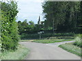
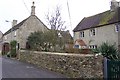
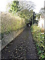
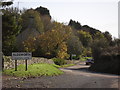
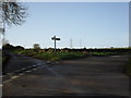

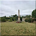

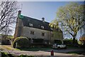

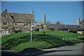
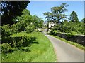
31 photos from this area
Area Information
Key information about the GL54 3QX including its size, population, and administrative classification.
- Area Type
- Postcode
- Area Size
- 1.7 hectares
- Population
- 1734
- Population Density
- 17 people/km²
House Prices in GL54 3QX
10
Properties
£876,083
Average Sold Price
£289,000
Lowest Price
£1,320,000
Highest Price
Showing 10 properties
| Address | Type | Beds | Baths | Last Sale Price | Last Sale Date | |
|---|---|---|---|---|---|---|
| Hill House, 400909 The War Memorial Aldsworth, Aldsworth, GL54 3QX | house | - | - | £550,000 | May 2022 | |
| Smiths Corner Cottage, Smiths Corner, Aldsworth, GL54 3QX | house | - | - | £1,320,000 | Oct 2021 | |
| Stable End, 400909 The War Memorial Aldsworth, Aldsworth, GL54 3QX | house | - | - | £1,157,500 | Nov 2020 | |
| The Paddock, 400909 The War Memorial Aldsworth, Aldsworth, GL54 3QX | Detached | 4 | 2 | £670,000 | Jun 2015 | |
| Waylands Barn, Smiths Corner, Aldsworth, GL54 3QX | house | 5 | - | £1,270,000 | Sep 2011 | |
| Hillcrest, 400909 The War Memorial Aldsworth, Aldsworth, GL54 3QX | house | - | - | £289,000 | Feb 2009 | |
| Taylers Farmhouse, Bakehouse Lane, Aldsworth, GL54 3QX | house | 6 | - | - | - | |
| Whitegates, Smiths Lane, Aldsworth, GL54 3QX | Detached | - | - | - | - | |
| Smiths Cottage, Bakehouse Lane, Aldsworth, GL54 3QX | Terraced | - | - | - | - | |
| The Old Post Office, 400909 The War Memorial Aldsworth, Aldsworth, GL54 3QX | Detached | - | - | - | - |
Energy Efficiency in GL54 3QX
Amenities
Schools
| Rank | School | Type | Entry gender | Ages |
|---|
Explore more schools in this area
Go to Schools tabDemographics
Household Size
Two person
most common
Accommodation Type
Houses
most common
Tenure
56
majority
Ethnic Group
White
most common
Religion
N/A
most common
Household Composition
N/A
most common
Age
47
median
Adults (30-64 years)
most common
Household Deprivation
N/A
with no deprivation
NS-SEC
43
in Lower managerial occupations
Explore more demographic insights in this area
Go to Demographics tabPlanning
Planning Constraints
- Flood RiskPremium
- Ramsar Wetland SitesPremium
- Area of Outstanding Natural BeautyPremium
- Protected Nature ReservePremium
- Protected WoodlandPremium