Area Overview for GL54 3LE
Photos of GL54 3LE

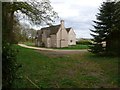
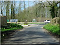
![A walk around the Fosse Way [27] in GL54 3LE](https://images.propbar.co.uk/images/geograph/69/96/6996686_120.jpg)
27 photos from this area
Area Information
Key information about the GL54 3LE including its size, population, and administrative classification.
- Area Type
- Postcode
- Area Size
- 1.0 km²
- Population
- 1629
- Population Density
- 24 people/km²
House Prices in GL54 3LE
14
Properties
-
Average Sold Price
-
Lowest Price
-
Highest Price
Showing 14 properties
| Address | Type | Beds | Baths | Last Sale Price | Last Sale Date | |
|---|---|---|---|---|---|---|
| The Bothy, Stowell Park Cottages, Stowell Park, Yanworth, GL54 3LE | Flat | - | - | - | - | |
| The Stable Flat, Stowell Park, Yanworth, GL54 3LE | Flat | - | - | - | - | |
| 2, Stable Cottages, Stowell Park, Yanworth, GL54 3LE | house | - | - | - | - | |
| 1, Stable Cottages, Stowell Park, Yanworth, GL54 3LE | house | - | - | - | - | |
| Stowell Park, Stowell Park, Yanworth, GL54 3LE | Detached | 3 | - | - | - | |
| Gardeners Cottage, Stowell Park, Yanworth, GL54 3LE | Semi-detached | - | - | - | - | |
| 5, Home Farm Cottages, Stowell Park, Yanworth, GL54 3LE | house | - | - | - | - | |
| 4, Home Farm Cottages, Stowell Park, Yanworth, GL54 3LE | Semi-detached | - | - | - | - | |
| 3, Home Farm Cottages, Stowell Park, Yanworth, GL54 3LE | house | 3 | 1 | - | - | |
| The Old Laundry, Stowell Park, Yanworth, GL54 3LE | Detached | - | - | - | - |
Page 1 of 2
Energy Efficiency in GL54 3LE
Amenities
Schools
| Rank | School | Type | Entry gender | Ages |
|---|
Explore more schools in this area
Go to Schools tabDemographics
Household Size
Two person
most common
Accommodation Type
Houses
most common
Tenure
71
majority
Ethnic Group
White
most common
Religion
N/A
most common
Household Composition
N/A
most common
Age
47
median
Adults (30-64 years)
most common
Household Deprivation
N/A
with no deprivation
NS-SEC
46
in Lower managerial occupations
Explore more demographic insights in this area
Go to Demographics tabPlanning
Planning Constraints
- Flood RiskPremium
- Ramsar Wetland SitesPremium
- Area of Outstanding Natural BeautyPremium
- Protected Nature ReservePremium
- Protected WoodlandPremium