Area Overview for GL54 3HG
Photos of GL54 3HG
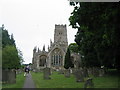


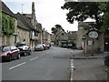


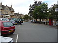
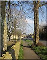
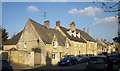
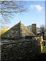
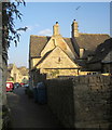
100 photos from this area
Area Information
Key information about the GL54 3HG including its size, population, and administrative classification.
- Area Type
- Postcode
- Area Size
- 9966 m²
- Population
- 1995
- Population Density
- 91 people/km²
House Prices in GL54 3HG
22
Properties
£363,588
Average Sold Price
£79,400
Lowest Price
£612,500
Highest Price
Showing 22 properties
| Address | Type | Beds | Baths | Last Sale Price | Last Sale Date | |
|---|---|---|---|---|---|---|
| 2, Bank Villas, West End, Northleach, GL54 3HG | house | - | - | £395,000 | Mar 2025 | |
| Corston Cottage, West End, Northleach, GL54 3HG | Terraced | 2 | 1 | £450,000 | Dec 2024 | |
| Leeth House, West End, Northleach, GL54 3HG | Semi-detached | 4 | 2 | £612,500 | Dec 2024 | |
| Fairholme, West End, Northleach, GL54 3HG | Cottage | 2 | 1 | £338,000 | Dec 2023 | |
| Ayton Cottage, West End, Northleach, GL54 3HG | Detached | 2 | 3 | £250,000 | Dec 2020 | |
| 4, Bank Villas, West End, Northleach, GL54 3HG | house | 3 | 1 | £385,000 | Dec 2020 | |
| Craddock House, West End, Northleach, GL54 3HG | house | 4 | - | £478,500 | Apr 2018 | |
| Prospect Cottage, West End, Northleach, GL54 3HG | Cottage | 3 | - | £480,000 | Jul 2016 | |
| 3, Bank Villas, West End, Northleach, GL54 3HG | house | - | - | £315,000 | Dec 2015 | |
| Orcheton House, West End, Northleach, GL54 3HG | Terraced | 4 | 1 | £415,000 | Aug 2015 |
Page 1 of 3
Energy Efficiency in GL54 3HG
Amenities
Schools
| Rank | School | Type | Entry gender | Ages |
|---|
Explore more schools in this area
Go to Schools tabDemographics
Household Size
Two person
most common
Accommodation Type
Houses
most common
Tenure
68
majority
Ethnic Group
White
most common
Religion
N/A
most common
Household Composition
N/A
most common
Age
47
median
Adults (30-64 years)
most common
Household Deprivation
N/A
with no deprivation
NS-SEC
41
in Lower managerial occupations
Explore more demographic insights in this area
Go to Demographics tabPlanning
Planning Constraints
- Flood RiskPremium
- Ramsar Wetland SitesPremium
- Area of Outstanding Natural BeautyPremium
- Protected Nature ReservePremium
- Protected WoodlandPremium