Area Overview for GL54 2QN
Photos of GL54 2QN
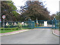
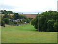
![Little Rissington Airfield [1] in GL54 2QN](https://images.propbar.co.uk/images/geograph/27/32/2732351_120.jpg)
24 photos from this area
Area Information
Key information about the GL54 2QN including its size, population, and administrative classification.
- Area Type
- Postcode
- Area Size
- 3.5 hectares
- Population
- 1599
- Population Density
- 2299 people/km²
House Prices in GL54 2QN
46
Properties
£294,998
Average Sold Price
£206,250
Lowest Price
£425,000
Highest Price
Showing 46 properties
| Address | Type | Beds | Baths | Last Sale Price | Last Sale Date | |
|---|---|---|---|---|---|---|
| 34 Godfrey Place, Upper Rissington, GL54 2QN | Semi-detached | 4 | 2 | £360,000 | Jul 2024 | |
| 31 Godfrey Place, Upper Rissington, GL54 2QN | Semi-detached | 3 | 2 | £425,000 | Nov 2023 | |
| 25 Godfrey Place, Upper Rissington, GL54 2QN | Semi-detached | 3 | 2 | £425,000 | Jan 2023 | |
| 38 Godfrey Place, Upper Rissington, GL54 2QN | Semi-detached | 3 | 2 | £333,000 | Sep 2022 | |
| 21 Godfrey Place, Upper Rissington, GL54 2QN | house | - | - | £380,000 | May 2021 | |
| 14 Godfrey Place, Upper Rissington, GL54 2QN | house | - | - | £235,000 | Apr 2021 | |
| 32 Godfrey Place, Upper Rissington, GL54 2QN | house | - | - | £310,000 | Feb 2021 | |
| 36 Godfrey Place, Upper Rissington, GL54 2QN | Semi-detached | 3 | 2 | £283,000 | Oct 2020 | |
| 17 Godfrey Place, Upper Rissington, GL54 2QN | Semi-detached | 4 | 3 | £362,500 | Mar 2020 | |
| 3 Godfrey Place, Upper Rissington, GL54 2QN | house | - | - | £327,500 | Sep 2018 |
Page 1 of 5
Energy Efficiency in GL54 2QN
Amenities
Schools
| Rank | School | Type | Entry gender | Ages |
|---|
Explore more schools in this area
Go to Schools tabDemographics
Household Size
Family (3-5 people)
most common
Accommodation Type
Houses
most common
Tenure
79
majority
Ethnic Group
White
most common
Religion
N/A
most common
Household Composition
N/A
most common
Age
47
median
Adults (30-64 years)
most common
Household Deprivation
N/A
with no deprivation
NS-SEC
44
in Lower managerial occupations
Explore more demographic insights in this area
Go to Demographics tabPlanning
Planning Constraints
- Flood RiskPremium
- Ramsar Wetland SitesPremium
- Area of Outstanding Natural BeautyPremium
- Protected Nature ReservePremium
- Protected WoodlandPremium