Area Overview for GL54 2LY
Photos of GL54 2LY
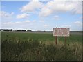
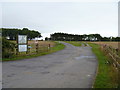
![Little Rissington Airfield [2] in GL54 2LY](https://images.propbar.co.uk/images/geograph/27/32/2732375_120.jpg)
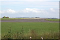
![Little Rissington Airfield [4] in GL54 2LY](https://images.propbar.co.uk/images/geograph/27/32/2732399_120.jpg)

12 photos from this area
Area Information
Key information about the GL54 2LY including its size, population, and administrative classification.
- Area Type
- Postcode
- Area Size
- 66.6 hectares
- Population
- 1431
- Population Density
- 45 people/km²
House Prices in GL54 2LY
21
Properties
£160,076
Average Sold Price
£67,500
Lowest Price
£240,000
Highest Price
Showing 21 properties
| Address | Type | Beds | Baths | Last Sale Price | Last Sale Date | |
|---|---|---|---|---|---|---|
| 4 Southgate Court, Upper Rissington, GL54 2LY | Terraced | 3 | 1 | £220,000 | Jun 2025 | |
| 5 Southgate Court, Upper Rissington, GL54 2LY | Terraced | 2 | 1 | £220,000 | Dec 2024 | |
| 6 Southgate Court, Upper Rissington, GL54 2LY | Terraced | 3 | 1 | £190,000 | Jan 2024 | |
| 17 Southgate Court, Upper Rissington, GL54 2LY | Terraced | 2 | 1 | £200,000 | Aug 2023 | |
| 10 Southgate Court, Upper Rissington, GL54 2LY | Terraced | 3 | 2 | £240,000 | Oct 2022 | |
| 12 Southgate Court, Upper Rissington, GL54 2LY | Terraced | 3 | 1 | £234,000 | Sep 2022 | |
| 13 Southgate Court, Upper Rissington, GL54 2LY | Terraced | 3 | - | £205,000 | Mar 2021 | |
| 16 Southgate Court, Upper Rissington, GL54 2LY | Terraced | 3 | 1 | £185,000 | Sep 2017 | |
| 19 Southgate Court, Upper Rissington, GL54 2LY | house | 2 | 1 | £195,000 | Aug 2017 | |
| 9 Southgate Court, Upper Rissington, GL54 2LY | house | - | - | £189,950 | Mar 2014 |
Page 1 of 3
Energy Efficiency in GL54 2LY
Amenities
Schools
| Rank | School | Type | Entry gender | Ages |
|---|
Explore more schools in this area
Go to Schools tabDemographics
Household Size
Two person
most common
Accommodation Type
Houses
most common
Tenure
74
majority
Ethnic Group
White
most common
Religion
N/A
most common
Household Composition
N/A
most common
Age
47
median
Adults (30-64 years)
most common
Household Deprivation
N/A
with no deprivation
NS-SEC
43
in Lower managerial occupations
Explore more demographic insights in this area
Go to Demographics tabPlanning
Planning Constraints
- Flood RiskPremium
- Ramsar Wetland SitesPremium
- Area of Outstanding Natural BeautyPremium
- Protected Nature ReservePremium
- Protected WoodlandPremium