Area Overview for GL54 2AA
Photos of GL54 2AA


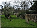


100 photos from this area
Area Information
Key information about the GL54 2AA including its size, population, and administrative classification.
- Area Type
- Postcode
- Area Size
- 3.3 hectares
- Population
- 1414
- Population Density
- 1229 people/km²
House Prices in GL54 2AA
16
Properties
£946,444
Average Sold Price
£137,000
Lowest Price
£3,325,000
Highest Price
Showing 16 properties
| Address | Type | Beds | Baths | Last Sale Price | Last Sale Date | |
|---|---|---|---|---|---|---|
| Three Wells House, Station Road, Bourton On The Water, GL54 2AA | Detached | 6 | 3 | £1,738,000 | Aug 2025 | |
| The Manor, Station Road, Bourton On The Water, GL54 2AA | house | 7 | 5 | £3,325,000 | Apr 2024 | |
| Manor Lodge, Station Road, Bourton On The Water, GL54 2AA | Detached | 3 | 3 | £533,000 | Apr 2024 | |
| Chapel Cottage, 7 Station Road, Bourton On The Water, GL54 2AA | Cottage | 3 | 1 | £550,000 | May 2023 | |
| 2, Cheviot Corner, The Larches, Station Road, Bourton On The Water, GL54 2AA | house | 4 | - | £540,000 | Aug 2013 | |
| Halford House, Station Road, Bourton On The Water, GL54 2AA | Detached | 8 | 6 | £795,000 | Mar 2011 | |
| Foxes Manor, Station Road, Bourton On The Water, GL54 2AA | house | - | - | £500,000 | Jul 2006 | |
| Old Coach House, Station Road, Bourton On The Water, GL54 2AA | Detached | 5 | 4 | £400,000 | Aug 2001 | |
| Halford Cottage, Station Road, Bourton On The Water, GL54 2AA | Semi-detached | - | - | £137,000 | Aug 1997 | |
| Garden House, Station Road, Bourton On The Water, GL54 2AA | Detached | 5 | 4 | - | - |
Page 1 of 2
Energy Efficiency in GL54 2AA
Amenities
Schools
| Rank | School | Type | Entry gender | Ages |
|---|
Explore more schools in this area
Go to Schools tabDemographics
Household Size
Two person
most common
Accommodation Type
Houses
most common
Tenure
56
majority
Ethnic Group
White
most common
Religion
N/A
most common
Household Composition
N/A
most common
Age
47
median
Adults (30-64 years)
most common
Household Deprivation
N/A
with no deprivation
NS-SEC
28
in Lower managerial occupations
Explore more demographic insights in this area
Go to Demographics tabPlanning
Planning Constraints
- Flood RiskPremium
- Ramsar Wetland SitesPremium
- Area of Outstanding Natural BeautyPremium
- Protected Nature ReservePremium
- Protected WoodlandPremium