Area Overview for GL54 1HJ
Photos of GL54 1HJ


Area Information
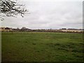
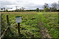
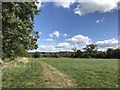
Living in GL54 1HJ offers a snapshot of a small, tightly knit residential community in England. With a population of 1,362 and a density of 1,277 people per square kilometre, this postcode area is compact, blending suburban comfort with rural proximity. The area is defined by its cluster of homes, predominantly owner-occupied, and a demographic skewed toward adults aged 30–64. Daily life here is shaped by local amenities and the quiet rhythm of a low-density neighbourhood. While it lacks the bustle of larger towns, GL54 1HJ provides a sense of security and simplicity. The absence of major environmental constraints, such as protected woodlands or flood-prone areas, ensures a stable living environment. Residents benefit from a low crime risk score of 72, making it a safe place for families and individuals alike. The area’s small size means that everything is within practical reach, from nearby shops to rail connections, offering a balance between convenience and tranquillity.
- Area Type
- Postcode
- Area Size
- Not available
- Population
- 1362
- Population Density
- 1277 people/km²
The property market in GL54 1HJ is characterised by a high rate of home ownership—65% of residents own their homes—which suggests a strong preference for long-term residency over rental living. The accommodation types are predominantly houses, indicating a lack of high-density housing or apartments. This makes the area more suitable for families or individuals seeking private, standalone properties rather than flats. Given the small size of the postcode area, the housing stock is limited, and buyers should consider the immediate surroundings for more options. The high home ownership rate also implies a stable market with less turnover, which could be advantageous for those seeking a reliable investment. However, the limited number of properties may mean competition for available homes, particularly for those prioritising specific features or locations.
House Prices in GL54 1HJ
No properties found in this postcode.
Energy Efficiency in GL54 1HJ
Residents of GL54 1HJ have access to a range of local amenities within practical reach. The area includes five retail outlets, such as Co-op Bourton on the, Co-op Petrol, and Budgens Bourton, providing essential shopping and fuel services. The nearest rail station, Kingham Railway Station, offers connectivity to broader transport networks, enabling travel to nearby towns. While the area is small, the presence of these amenities suggests a self-contained lifestyle, where daily needs can be met locally. The shops and rail link contribute to a convenient, low-stress routine, ideal for those who prefer to avoid long commutes. The character of the area is defined by its modest scale, with a focus on practicality and accessibility, making it suitable for individuals or families seeking a quiet, well-served community.
Amenities
Schools
| Rank | School | Type | Entry gender | Ages |
|---|
Explore more schools in this area
Go to Schools tabDemographics
The community in GL54 1HJ is predominantly composed of adults aged 30–64, with a median age of 47. This suggests a mature, established population, likely with strong family ties and long-term residency. Home ownership is high, with 65% of residents owning their properties, while the remaining 35% are likely to be renters. The accommodation types are primarily houses, reflecting a preference for single-family homes over flats or apartments. The predominant ethnic group is White, which aligns with the broader demographic trends in rural and semi-rural England. While no specific data on deprivation or diversity is provided, the high home ownership rate and age profile indicate a stable, low-turnover community. This demographic makeup may influence local services and amenities, tailored to the needs of a middle-aged, largely settled population.
Household Size
Accommodation Type
Tenure
Ethnic Group
Religion
Household Composition
Age
Household Deprivation
NS-SEC
Explore more demographic insights in this area
Go to Demographics tabPlanning
Planning Constraints
- Flood RiskPremium
- Ramsar Wetland SitesPremium
- Area of Outstanding Natural BeautyPremium
- Protected Nature ReservePremium
- Protected WoodlandPremium