Area Overview for GL54 1EA
Photos of GL54 1EA
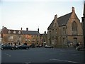
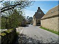
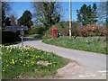
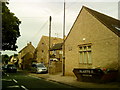
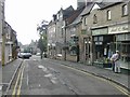
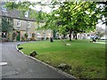
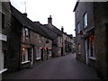

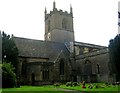
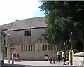
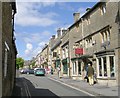
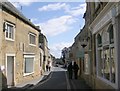
100 photos from this area
Area Information
Key information about the GL54 1EA including its size, population, and administrative classification.
- Area Type
- Postcode
- Area Size
- 9334 m²
- Population
- 1903
- Population Density
- 1271 people/km²
House Prices in GL54 1EA
27
Properties
£301,290
Average Sold Price
£58,000
Lowest Price
£575,000
Highest Price
Showing 27 properties
| Address | Type | Beds | Baths | Last Sale Price | Last Sale Date | |
|---|---|---|---|---|---|---|
| 22 Shepherds Way, Stow On The Wold, GL54 1EA | Terraced | 3 | 1 | £427,000 | Jul 2024 | |
| 8 Shepherds Way, Stow On The Wold, GL54 1EA | house | 2 | 1 | £470,000 | Apr 2024 | |
| Queens Cottage, Shepherds Way, Stow On The Wold, GL54 1EA | Detached | 3 | 3 | £575,000 | Mar 2024 | |
| Crooksbury, 10 Shepherds Way, Stow On The Wold, GL54 1EA | house | - | - | £277,500 | Jun 2021 | |
| 6 SHEPHERDS WAY, Stow-on-the-Wold, GL54 1EA | Detached | - | - | £307,500 | Dec 2020 | |
| 9 Shepherds Way, Stow On The Wold, GL54 1EA | Semi-detached | 2 | 1 | £295,000 | Jul 2020 | |
| 14 Shepherds Way, Stow On The Wold, GL54 1EA | Detached | 3 | 1 | £327,500 | Dec 2018 | |
| 17 Shepherds Way, Stow On The Wold, GL54 1EA | house | - | - | £293,000 | Aug 2017 | |
| 7 Shepherds Way, Stow On The Wold, GL54 1EA | Semi-detached | 3 | 1 | £329,950 | Jun 2017 | |
| 23 Shepherds Way, Stow On The Wold, GL54 1EA | Terraced | 3 | 2 | £325,000 | Mar 2017 |
Page 1 of 3
Energy Efficiency in GL54 1EA
Amenities
Schools
| Rank | School | Type | Entry gender | Ages |
|---|
Explore more schools in this area
Go to Schools tabDemographics
Household Size
One person
most common
Accommodation Type
Houses
most common
Tenure
68
majority
Ethnic Group
White
most common
Religion
N/A
most common
Household Composition
N/A
most common
Age
47
median
Adults (30-64 years)
most common
Household Deprivation
N/A
with no deprivation
NS-SEC
34
in Lower managerial occupations
Explore more demographic insights in this area
Go to Demographics tabPlanning
Planning Constraints
- Flood RiskPremium
- Ramsar Wetland SitesPremium
- Area of Outstanding Natural BeautyPremium
- Protected Nature ReservePremium
- Protected WoodlandPremium