Area Overview for GL54 1AA
Photos of GL54 1AA
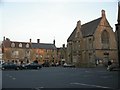
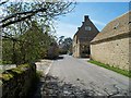
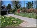
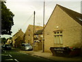
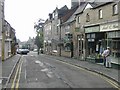
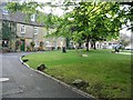
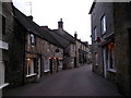

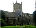
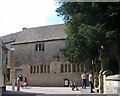
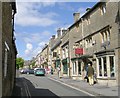
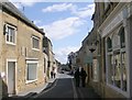
100 photos from this area
Area Information
Key information about the GL54 1AA including its size, population, and administrative classification.
- Area Type
- Postcode
- Area Size
- 1.4 hectares
- Population
- 1903
- Population Density
- 1271 people/km²
House Prices in GL54 1AA
41
Properties
£418,030
Average Sold Price
£150,000
Lowest Price
£690,000
Highest Price
Showing 41 properties
| Address | Type | Beds | Baths | Last Sale Price | Last Sale Date | |
|---|---|---|---|---|---|---|
| Cotswold Cottage, Sheep Street, Stow On The Wold, GL54 1AA | Terraced | 1 | 1 | £690,000 | Sep 2025 | |
| Guinevere House, Sheep Street, Stow On The Wold, GL54 1AA | house | 3 | 2 | £625,000 | Sep 2023 | |
| PETITE ETOILE, HUNTINGTON COURTYARD, SHEEP STREET, Stow-on-the-Wold, GL54 1AA | Semi-detached | 2 | 2 | £437,500 | Oct 2020 | |
| Burgage House, Sheep Street, Stow On The Wold, GL54 1AA | house | 3 | - | £400,000 | Apr 2019 | |
| Chantry House, Sheep Street, Stow On The Wold, GL54 1AA | Flat | - | - | £430,000 | Aug 2018 | |
| St Anthonys Cottage, Sheep Street, Stow On The Wold, GL54 1AA | house | - | - | £300,000 | Mar 2018 | |
| Beauport, Sheep Street, Stow On The Wold, GL54 1AA | house | - | - | £548,000 | Jan 2018 | |
| Rooftops, Sheep Street, Stow On The Wold, GL54 1AA | Terraced | 4 | - | £430,000 | Sep 2017 | |
| Chure House, Sheep Street, Stow On The Wold, GL54 1AA | house | - | - | £650,000 | Oct 2013 | |
| Close Cottage, Sheep Street, Stow On The Wold, GL54 1AA | Terraced | 2 | 1 | £249,950 | Dec 2010 |
Page 1 of 5
Energy Efficiency in GL54 1AA
Amenities
Schools
| Rank | School | Type | Entry gender | Ages |
|---|
Explore more schools in this area
Go to Schools tabDemographics
Household Size
One person
most common
Accommodation Type
Houses
most common
Tenure
68
majority
Ethnic Group
White
most common
Religion
N/A
most common
Household Composition
N/A
most common
Age
47
median
Adults (30-64 years)
most common
Household Deprivation
N/A
with no deprivation
NS-SEC
34
in Lower managerial occupations
Explore more demographic insights in this area
Go to Demographics tabPlanning
Planning Constraints
- Flood RiskPremium
- Ramsar Wetland SitesPremium
- Area of Outstanding Natural BeautyPremium
- Protected Nature ReservePremium
- Protected WoodlandPremium