Area Overview for GL53 8HT
Photos of GL53 8HT
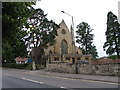


![Cheltenham houses [65] in GL53 8HT](https://images.propbar.co.uk/images/geograph/65/37/6537368_120.jpg)
100 photos from this area
Area Information
Key information about the GL53 8HT including its size, population, and administrative classification.
- Area Type
- Postcode
- Area Size
- 9374 m²
- Population
- 1531
- Population Density
- 4228 people/km²
House Prices in GL53 8HT
15
Properties
£641,857
Average Sold Price
£277,000
Lowest Price
£1,925,000
Highest Price
Showing 15 properties
| Address | Type | Beds | Baths | Last Sale Price | Last Sale Date | |
|---|---|---|---|---|---|---|
| 14 Cudnall Street, Charlton Kings, Cheltenham, GL53 8HT | Semi-detached | 3 | 1 | £385,000 | Oct 2024 | |
| 4 Cudnall Street, Charlton Kings, Cheltenham, GL53 8HT | Detached | 2 | 2 | £715,000 | Sep 2023 | |
| 8 Cudnall Street, Charlton Kings, Cheltenham, GL53 8HT | Detached | 6 | 4 | £1,925,000 | Mar 2021 | |
| 20 Cudnall Street, Charlton Kings, Cheltenham, GL53 8HT | house | - | - | £380,000 | Apr 2019 | |
| 18 Cudnall Street, Charlton Kings, Cheltenham, GL53 8HT | Terraced | 2 | 2 | £311,000 | Oct 2018 | |
| 16 Cudnall Street, Charlton Kings, Cheltenham, GL53 8HT | Semi-detached | 3 | 1 | £277,000 | Jan 2016 | |
| 22 Cudnall Street, Charlton Kings, Cheltenham, GL53 8HT | Semi-detached | 5 | - | £500,000 | Aug 2013 | |
| Flat 4, 6 Cudnall Street, Charlton Kings, Cheltenham, GL53 8HT | Flat | 2 | 2 | - | - | |
| Flat 5, 6 Cudnall Street, Charlton Kings, Cheltenham, GL53 8HT | Flat | 2 | 2 | - | - | |
| Flat 6, 6 Cudnall Street, Charlton Kings, Cheltenham, GL53 8HT | Flat | 3 | 2 | - | - |
Page 1 of 2
Energy Efficiency in GL53 8HT
Amenities
Schools
| Rank | School | Type | Entry gender | Ages |
|---|
Explore more schools in this area
Go to Schools tabDemographics
Household Size
Family (3-5 people)
most common
Accommodation Type
Houses
most common
Tenure
79
majority
Ethnic Group
White
most common
Religion
N/A
most common
Household Composition
N/A
most common
Age
47
median
Adults (30-64 years)
most common
Household Deprivation
N/A
with no deprivation
NS-SEC
52
in Lower managerial occupations
Explore more demographic insights in this area
Go to Demographics tabPlanning
Planning Constraints
- Flood RiskPremium
- Ramsar Wetland SitesPremium
- Area of Outstanding Natural BeautyPremium
- Protected Nature ReservePremium
- Protected WoodlandPremium