Area Overview for GL53 7EB
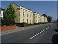
Photos of GL53 7EB


Area Information
Living in GL53 7EB offers a compact, residential experience shaped by its small area size of 3,376 square metres and a population of 1,608 people. The high population density of 476,315 people per square kilometre reflects a tightly knit community, ideal for those seeking proximity to amenities without urban sprawl. This postcode area, located in England, is a small cluster of homes, predominantly occupied by owners. Daily life here is influenced by its proximity to nearby towns, with residents benefitting from a mix of local shops, transport links, and schools. While the area is not large, its strategic placement near Cheltenham and surrounding villages ensures access to broader services. The demographic profile—skewed toward adults aged 30–64—suggests a stable, mature community, with a strong focus on home ownership. For buyers, GL53 7EB represents a blend of practicality and convenience, though its limited size means housing stock is finite. The area’s appeal lies in its balance of quiet living and accessibility to essential services.
- Area Type
- Postcode
- Area Size
- 3376 m²
- Population
- 1608
- Population Density
- 4540 people/km²
The property market in GL53 7EB is characterised by a high rate of home ownership—80%—and a predominance of houses over other accommodation types. This indicates a market skewed toward owner-occupied properties rather than rentals, which may limit availability for buyers seeking to rent. The small area size of 3,376 square metres and high population density suggest a limited housing stock, meaning properties are likely to be in demand. Given the compact nature of the postcode, buyers should consider proximity to nearby towns for additional housing options. The focus on houses implies a preference for traditional, family-friendly homes, which may appeal to those prioritising space and privacy. However, the area’s size means that new developments are unlikely, and the market is likely to remain stable with minimal price fluctuations. For buyers, GL53 7EB offers a chance to secure a home in a tightly held, mature community, though competition for properties may be fierce.
House Prices in GL53 7EB
No properties found in this postcode.
Energy Efficiency in GL53 7EB
Residents of GL53 7EB have access to a range of nearby amenities, including five retail outlets such as Co-op Leckhampton, Cook Cheltenham, and Co-op Bath. These shops provide essential services and local shopping options, reducing the need to travel far for daily needs. The area’s proximity to Cheltenham Spa Railway Station and metro stops like Cheltenham Racecourse and Gotherington enhances its connectivity, enabling easy access to leisure, dining, and cultural activities in nearby towns. While the data does not specify parks or recreational facilities, the presence of multiple transport links and retail options suggests a lifestyle that balances convenience with accessibility. The small area size means amenities are closely grouped, fostering a sense of community. For those prioritising practicality, GL53 7EB offers a compact environment where essential services are within reach, though larger-scale leisure options may require travel to nearby hubs.
Amenities
Schools
The nearest school to GL53 7EB is Naunton Park Primary School, which holds an Ofsted rating of 'good'. This institution serves the local community, providing education for younger children in the area. While no secondary schools are listed in the data, the presence of a primary school with a solid rating suggests that families with young children may find the area suitable for their needs. The school’s performance is a key factor for parents considering GL53 7EB, as it directly impacts the quality of education available. The absence of additional schools in the data means that families may need to look beyond the immediate postcode for secondary education options. Nonetheless, the primary school’s 'good' rating indicates a reliable foundation for early education, which is a significant consideration for prospective homebuyers with children.
| Rank | School | Type | Entry gender | Ages |
|---|
Explore more schools in this area
Go to Schools tabDemographics
The community in GL53 7EB is predominantly composed of adults aged 30–64, with a median age of 47. This suggests a mature, established population, likely with long-term ties to the area. Home ownership is high, at 80%, indicating a stable housing market with few rental properties. The accommodation type is primarily houses, reflecting a preference for single-family homes over flats or apartments. The predominant ethnic group is White, though no specific diversity statistics are provided. The high home ownership rate and age profile imply a low turnover of residents, fostering a sense of continuity. With 1,608 people in a small area, the community is closely knit, though the density may limit the presence of younger families or transient populations. The data does not indicate deprivation levels, but the age range and ownership figures suggest a middle-to-upper-income demographic with established careers and family structures.
Household Size
Accommodation Type
Tenure
Ethnic Group
Religion
Household Composition
Age
Household Deprivation
NS-SEC
Explore more demographic insights in this area
Go to Demographics tabPlanning
Planning Constraints
- Flood RiskPremium
- Ramsar Wetland SitesPremium
- Area of Outstanding Natural BeautyPremium
- Protected Nature ReservePremium
- Protected WoodlandPremium