Area Overview for GL52 9PU
Photos of GL52 9PU
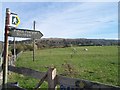
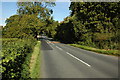
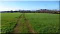
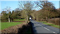
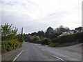

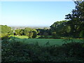
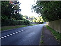
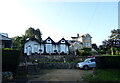
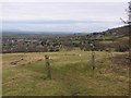
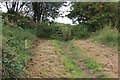
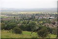
22 photos from this area
Area Information
Key information about the GL52 9PU including its size, population, and administrative classification.
- Area Type
- Postcode
- Area Size
- 30.8 hectares
- Population
- 2106
- Population Density
- 88 people/km²
House Prices in GL52 9PU
38
Properties
£453,330
Average Sold Price
£6,000
Lowest Price
£1,135,000
Highest Price
Showing 38 properties
| Address | Type | Beds | Baths | Last Sale Price | Last Sale Date | |
|---|---|---|---|---|---|---|
| White Cottage, Gambles Lane, Woodmancote, Cheltenham, GL52 9PU | Semi-detached | 4 | 2 | £635,000 | Sep 2023 | |
| Langdene, Gambles Lane, Woodmancote, Cheltenham, GL52 9PU | Semi-detached | 2 | 2 | £320,000 | Dec 2020 | |
| Hillside Cottage, Gambles Lane, Woodmancote, Cheltenham, GL52 9PU | Semi-detached | 4 | 2 | £705,000 | Oct 2020 | |
| Byways, Gambles Lane, Woodmancote, Cheltenham, GL52 9PU | Bungalow | 3 | - | £425,000 | Apr 2020 | |
| Gambles House, Gambles Lane, Woodmancote, Cheltenham, GL52 9PU | house | - | - | £650,000 | Jan 2020 | |
| Bottomley Farmhouse, Gambles Lane, Woodmancote, Cheltenham, GL52 9PU | house | - | - | £1,135,000 | Dec 2019 | |
| Castle Martyr, Gambles Lane, Woodmancote, Cheltenham, GL52 9PU | Detached | - | - | £6,000 | Feb 2018 | |
| Croft Cottage, Gambles Lane, Woodmancote, Cheltenham, GL52 9PU | house | 3 | - | £340,000 | May 2015 | |
| Thornhill, Gambles Lane, Woodmancote, Cheltenham, GL52 9PU | house | - | - | £680,000 | Dec 2009 | |
| Gambles Cottage, Gambles Lane, Woodmancote, Cheltenham, GL52 9PU | house | - | - | £625,000 | Sep 2007 |
Page 1 of 4
Energy Efficiency in GL52 9PU
Amenities
Schools
| Rank | School | Type | Entry gender | Ages |
|---|
Explore more schools in this area
Go to Schools tabDemographics
Household Size
Two person
most common
Accommodation Type
Houses
most common
Tenure
89
majority
Ethnic Group
White
most common
Religion
N/A
most common
Household Composition
N/A
most common
Age
47
median
Adults (30-64 years)
most common
Household Deprivation
N/A
with no deprivation
NS-SEC
51
in Lower managerial occupations
Explore more demographic insights in this area
Go to Demographics tabPlanning
Planning Constraints
- Flood RiskPremium
- Ramsar Wetland SitesPremium
- Area of Outstanding Natural BeautyPremium
- Protected Nature ReservePremium
- Protected WoodlandPremium