Area Overview for GL52 9HR
Photos of GL52 9HR
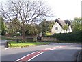
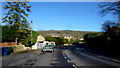
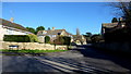
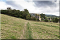


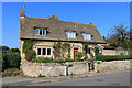
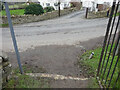
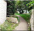
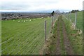
31 photos from this area
Area Information
Key information about the GL52 9HR including its size, population, and administrative classification.
- Area Type
- Postcode
- Area Size
- 2.3 hectares
- Population
- 1964
- Population Density
- 1442 people/km²
House Prices in GL52 9HR
49
Properties
£323,336
Average Sold Price
£108,000
Lowest Price
£835,000
Highest Price
Showing 49 properties
| Address | Type | Beds | Baths | Last Sale Price | Last Sale Date | |
|---|---|---|---|---|---|---|
| Windrush, Station Road, Woodmancote, Cheltenham, GL52 9HR | Terraced | 3 | 1 | £265,000 | May 2025 | |
| Dornie, Station Road, Woodmancote, Cheltenham, GL52 9HR | Semi-detached | 3 | 1 | £382,500 | May 2025 | |
| 6, Nutbridge Cottages, Station Road, Woodmancote, Cheltenham, GL52 9HR | Terraced | 3 | 2 | £357,500 | Aug 2024 | |
| The Ramblings, Station Road, Woodmancote, Cheltenham, GL52 9HR | Detached | 4 | 2 | £490,000 | Jan 2023 | |
| Oakleigh, Station Road, Woodmancote, Cheltenham, GL52 9HR | Detached | 3 | 2 | £457,500 | May 2021 | |
| Trentino, Station Road, Woodmancote, Cheltenham, GL52 9HR | house | - | - | £390,000 | May 2021 | |
| Chalfonts, Station Road, Woodmancote, Cheltenham, GL52 9HR | Semi-detached | 3 | - | £315,000 | Nov 2020 | |
| Merano, Station Road, Woodmancote, Cheltenham, GL52 9HR | house | - | - | £437,500 | Oct 2020 | |
| Tyrol, Station Road, Woodmancote, Cheltenham, GL52 9HR | Semi-detached | 4 | 2 | £455,000 | Feb 2020 | |
| Homelea, Station Road, Woodmancote, Cheltenham, GL52 9HR | Detached | 3 | - | £440,000 | Nov 2019 |
Page 1 of 5
Energy Efficiency in GL52 9HR
Amenities
Schools
| Rank | School | Type | Entry gender | Ages |
|---|
Explore more schools in this area
Go to Schools tabDemographics
Household Size
Two person
most common
Accommodation Type
Houses
most common
Tenure
86
majority
Ethnic Group
White
most common
Religion
N/A
most common
Household Composition
N/A
most common
Age
47
median
Adults (30-64 years)
most common
Household Deprivation
N/A
with no deprivation
NS-SEC
47
in Lower managerial occupations
Explore more demographic insights in this area
Go to Demographics tabPlanning
Planning Constraints
- Flood RiskPremium
- Ramsar Wetland SitesPremium
- Area of Outstanding Natural BeautyPremium
- Protected Nature ReservePremium
- Protected WoodlandPremium