Area Overview for GL52 8NE
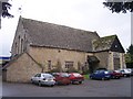
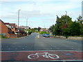
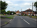
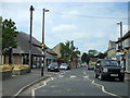
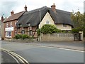
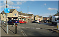
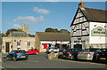
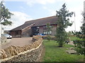
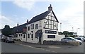
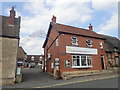
Photos of GL52 8NE


Area Information
Living in GL52 8NE means being part of a small, tightly knit residential cluster in England with a population of 1,227. This postcode area is characterised by its modest size and focus on housing, with most properties being family homes. The community is predominantly elderly, with a median age of 47 and a significant proportion of residents aged 65 and over. Daily life here is shaped by proximity to essential services and transport links. Residents benefit from nearby retail options such as Tesco Bishops and Co-op Bishops, while rail and metro connections to Cheltenham Spa Station and Winchcombe provide access to regional hubs. The area’s compact nature means amenities are within practical reach, though its small scale also means the housing stock is limited. For those seeking a quiet, low-density environment with a balance of local convenience and connectivity, GL52 8NE offers a distinct alternative to larger urban centres.
- Area Type
- Postcode
- Area Size
- Not available
- Population
- 1227
- Population Density
- 3572 people/km²
The property market in GL52 8NE is largely driven by owner-occupied homes, with 77% of properties owned by residents. This contrasts with areas where rental demand is higher, indicating a community of settled, long-term residents. The accommodation type is predominantly houses, which aligns with the area’s low-density, residential character. Given the small size of the postcode and its focus on housing, the market is likely limited in scale, with few new developments. Buyers should consider that the area’s compact nature means property choices are constrained, and proximity to amenities such as retail and transport is a key selling point. For those seeking a quiet, stable environment with established housing stock, GL52 8NE offers a niche opportunity, though its small size may limit availability for those needing larger or more varied options.
House Prices in GL52 8NE
No properties found in this postcode.
Energy Efficiency in GL52 8NE
Daily life in GL52 8NE is shaped by its proximity to essential retail and transport hubs. The area is served by five retail outlets, including Tesco Bishops, Lidl Bishop’s, and Co-op Bishops, providing residents with convenient access to groceries and everyday essentials. Nearby metro stations such as Gotherington and Winchcombe offer links to regional destinations, while rail services at Cheltenham Spa Station connect to broader networks. The presence of three Gloucestershire Airport locations adds to the area’s accessibility for travel. While the data does not specify parks or leisure facilities, the availability of retail and transport options suggests a practical, service-oriented lifestyle. For residents valuing convenience and connectivity, GL52 8NE offers a compact environment where daily needs are met without the need for long commutes.
Amenities
Schools
| Rank | School | Type | Entry gender | Ages |
|---|
Explore more schools in this area
Go to Schools tabDemographics
The community in GL52 8NE is defined by its age profile, with a median age of 47 and a majority of residents aged 65 and over. This suggests a population skewed towards older adults, which may influence the character of local services and social dynamics. Home ownership is high, with 77% of properties owned by residents, indicating a stable, long-term demographic. The area is predominantly composed of houses, reflecting a traditional, low-density housing pattern. The predominant ethnic group is White, though no specific data on diversity or minority representation is provided. The absence of detailed information on household composition or deprivation levels means the area’s socioeconomic profile remains partially opaque. However, the high home ownership rate and age demographics suggest a community focused on retirement or long-term residency, with limited turnover of residents.
Household Size
Accommodation Type
Tenure
Ethnic Group
Religion
Household Composition
Age
Household Deprivation
NS-SEC
Explore more demographic insights in this area
Go to Demographics tabPlanning
Planning Constraints
- Flood RiskPremium
- Ramsar Wetland SitesPremium
- Area of Outstanding Natural BeautyPremium
- Protected Nature ReservePremium
- Protected WoodlandPremium