Area Overview for GL52 8JQ
Photos of GL52 8JQ
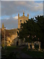
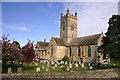
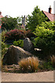
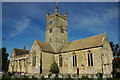
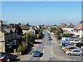
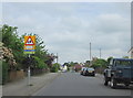
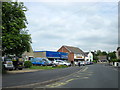
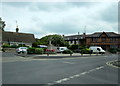
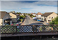
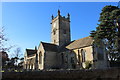
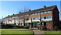
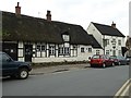
65 photos from this area
Area Information
Key information about the GL52 8JQ including its size, population, and administrative classification.
- Area Type
- Postcode
- Area Size
- 8707 m²
- Population
- 1469
- Population Density
- 5637 people/km²
House Prices in GL52 8JQ
24
Properties
£276,800
Average Sold Price
£145,000
Lowest Price
£390,000
Highest Price
Showing 24 properties
| Address | Type | Beds | Baths | Last Sale Price | Last Sale Date | |
|---|---|---|---|---|---|---|
| 14 Pecked Lane, Bishops Cleeve, Cheltenham, GL52 8JQ | Semi-detached | 3 | 1 | £322,500 | Apr 2024 | |
| 26 Pecked Lane, Bishops Cleeve, Cheltenham, GL52 8JQ | Bungalow | 2 | 1 | £330,000 | Oct 2023 | |
| 22 Pecked Lane, Bishops Cleeve, Cheltenham, GL52 8JQ | Semi-detached | 3 | 1 | £390,000 | Jul 2022 | |
| 78 Pecked Lane, Bishops Cleeve, Cheltenham, GL52 8JQ | Detached | 5 | 3 | £300,000 | Jan 2018 | |
| 70 Pecked Lane, Bishops Cleeve, Cheltenham, GL52 8JQ | Detached | 4 | 1 | £277,500 | Apr 2015 | |
| 76 Pecked Lane, Bishops Cleeve, Cheltenham, GL52 8JQ | Detached | 5 | 3 | £290,000 | Jun 2014 | |
| 32 Pecked Lane, Bishops Cleeve, Cheltenham, GL52 8JQ | house | 3 | - | £240,000 | Sep 2013 | |
| 30 Pecked Lane, Bishops Cleeve, Cheltenham, GL52 8JQ | Flat | - | - | £145,000 | Apr 2012 | |
| 20 Pecked Lane, Bishops Cleeve, Cheltenham, GL52 8JQ | Bungalow | - | - | £183,000 | Jan 2006 | |
| 36 Pecked Lane, Bishops Cleeve, Cheltenham, GL52 8JQ | Detached | - | - | £290,000 | Oct 2005 |
Page 1 of 3
Energy Efficiency in GL52 8JQ
Amenities
Schools
| Rank | School | Type | Entry gender | Ages |
|---|
Explore more schools in this area
Go to Schools tabDemographics
Household Size
Family (3-5 people)
most common
Accommodation Type
Houses
most common
Tenure
62
majority
Ethnic Group
White
most common
Religion
N/A
most common
Household Composition
N/A
most common
Age
47
median
Adults (30-64 years)
most common
Household Deprivation
N/A
with no deprivation
NS-SEC
27
in Lower managerial occupations
Explore more demographic insights in this area
Go to Demographics tabPlanning
Planning Constraints
- Flood RiskPremium
- Ramsar Wetland SitesPremium
- Area of Outstanding Natural BeautyPremium
- Protected Nature ReservePremium
- Protected WoodlandPremium